Catalog Archive
Auction 89, Lot 23

"A New and Complete Chart of the World; Displaying the Tracks of Capt. Cook, and other Modern Navigators",
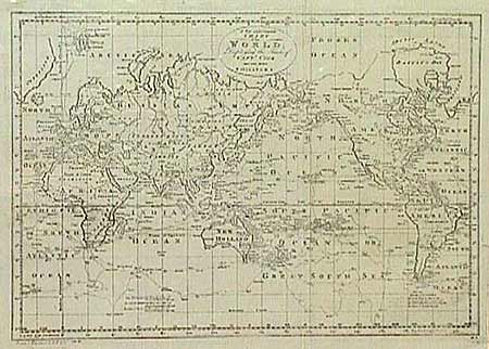
Subject: World

Period: 1790 (circa)

Publication: Bankes New System of Geography

Color: Black & White

Size:
18 x 13 inches
45.7 x 33 cm
Download High Resolution Image
(or just click on image to launch the Zoom viewer)

Fascinating map on Mercator's projection depicting the recent discoveries in the Pacific and northern oceans. Alaska is shown with a fairly correct shape. The Sandwich Islands are shown and noted as the place where Capt. Cook was killed. The South Pacific is filled with islands and New Zealand is fully formed. Tasmania is still attached to Australia, which is shown with an unexplored southern coastline. There are numerous notations throughout and the tracks of four separate major explorations. There is not a lot of interior detail, as the map concentrates on the voyages of discovery in the late 18th century. One tiny tear in margin and minor creasing along one fold. Overall clean and bright.

References:

Condition: A

Estimate: $400 - $475

Sold for: $450

Closed on 12/8/1999

Archived