Catalog Archive
Auction 89, Lot 126
"De Voor Eylanden van America Tegens de Vaste Kusten van Florida, Mexico, Nieuw Spanje, Cartegena, Iucatan en Darien Met de Grenzen aande Zude Zee Gelegen"
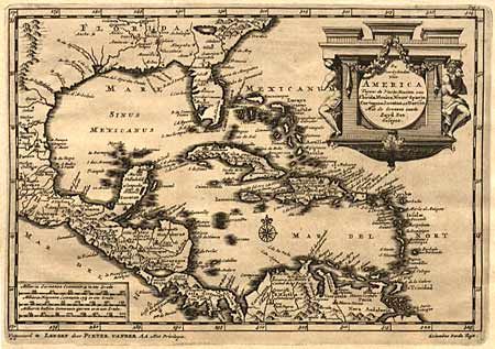
Subject: Southern United States, Central America and Caribbean
Period: 1710 (circa)
Publication: Cartes des Iteneraires et Voyages Modernes
Color: Black & White
Size:
9 x 6 inches
22.9 x 15.2 cm
Download High Resolution Image
(or just click on image to launch the Zoom viewer)
(or just click on image to launch the Zoom viewer)