Catalog Archive
Auction 89, Lot 108

"Map Showing the lines of Communication between Southern Colorado and Northern New Mexico",

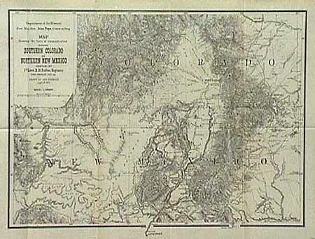
Subject: Colorado and New Mexico

Period: 1876 (dated)

Publication: U.S. War Dept.

Color: Black & White

Size:
18 x 14 inches
45.7 x 35.6 cm
Download High Resolution Image
(or just click on image to launch the Zoom viewer)

Depicts the region from Pueblo to Albuquerque and Fort Defiance to just east of Trinidad. Great topographical details as well as roads, towns, watering holes, pueblos and much more. The map was issued at the conclusion of Ruffner's 1873 expedition into Ute Country, to quell the unrest between the Ute Indians and the prospectors in the newly discovered San Juan Mining Region. It is a scarce map, full of information not found elsewhere. Tiny marginal split on fold, repaired with archival tape.

References:

Condition: A

Estimate: $120 - $150

Sold for: $160

Closed on 12/8/1999

Archived