Catalog Archive
Auction 88, Lot 338

"Insula S. Laurentii, vulgo Madagascar", Blaeu, Willem
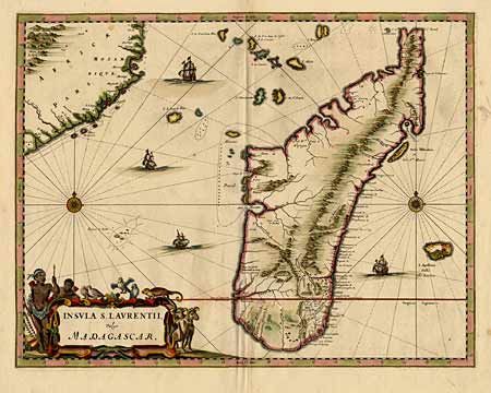
Subject: Madagascar

Period: 1662 (circa)

Publication:

Color: Hand Color

Size:
21.5 x 16.7 inches
54.6 x 42.4 cm
Download High Resolution Image
(or just click on image to launch the Zoom viewer)

Splendid copper engraved map of the island of Madagascar and the Mozambique coastline. One of the only sixteenth century maps to focus on this region. The title refers to the Portuguese name for the island, who called it St. Laurence on whose day (Feb. 2) they landed there in 1506. Blaeu based this map on a 1658 map by de Flacourt. Fine title cartouche with native people and wildlife. Further embellished with two compass roses and four sailing ships, all fully colored. Tissue repaired marginal split on fold, else very fine condition.

References:

Condition: A+

Estimate: $425 - $500

Sold for: $300

Closed on 10/2/1999

Archived