Catalog Archive
Auction 88, Lot 298

"China Neteribus Sinarum Regio nunc Incolis Tame dicta", Blaeu, Willem
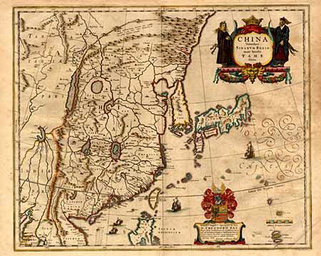
Subject: China

Period: 1635 (circa)

Publication:

Color: Hand Color

Size:
19.5 x 15 inches
49.5 x 38.1 cm
Download High Resolution Image
(or just click on image to launch the Zoom viewer)

Elegant 17th century map of China and Japan. The map is closely modeled on Jansson's map of 1633. The detail includes the eastern part of China (bounded in the west by the Great Wall), Korea as a strangely shaped island, and the three main islands of Japan. A fine title cartouche flanked by Chinese figures, a richly embellished coat of arms (dedicated to Theodore Bas, a director of the Dutch East India Company), European ships and Chinese sampans decorate the map. Very minor age toning mostly in margins. $1200 reserve

References:

Condition: A

Estimate: $1,400 - $1,500

Sold for: $1,700

Closed on 10/2/1999

Archived