Catalog Archive
Auction 88, Lot 140

"Regni Mexicani Novae Hispaniae, Floridae, Novae Angliae, Carolinae, Virginiae, et Pensylvaniae, necnon Insularum Archipelagi Mexicani in America Septentrionali accurata Tabula",

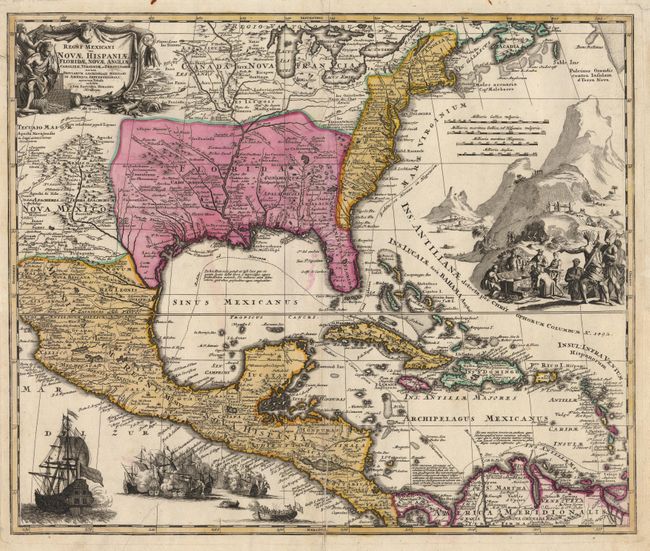
Subject: United States, Mexico and West Indies

Period: 1725 (circa)

Publication:

Color: Hand Color

Size:
22.5 x 18.7 inches
57.2 x 47.5 cm
Download High Resolution Image
(or just click on image to launch the Zoom viewer)

Magnificent, decorative map covering from the Great Lakes and Nova Scotia through Central America and Venezuela, and from present day Arizona to the eastern seaboard. The map is geographically based on an early work by Guillaume de l'Isle. The British colonies are shown confined east of the Appalachians. The map itself is filled with settlement place names, Indian tribes and villages. The sheet is richly embellished with a fine title cartouche depicting two native figures and symbols of America's natural resources. In the Atlantic is a large engraved scene of extensive gold mining operations with Indians bringing their treasures to fill the European's treasure chest. Off the Pacific coast of Mexico is yet another opulent engraving of a raging sea battle. Cartouche and engravings uncolored, with full color in map. Professionally backed with Japanese tissue, closing a tear that entered the map near the sea battle. Very crisp impression with printer's crease near bottom centerfold. Ref: Van Ermen p.42, Cumming (Southeast) #137, Martin & Martin plt.17.

References:

Condition: A

Estimate: $1,500 - $1,600

Sold for: $1,400

Closed on 10/2/1999

Archived