Catalog Archive
Auction 88, Lot 139

"Insulae Americanae in Oceano Septentrionale", Jansson
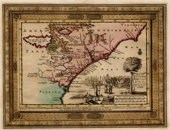
Subject: Caribbean

Period: 1636-66 (circa)

Publication:

Color: Hand Color

Size:
15 x 20.4 inches
38.1 x 51.8 cm
Download High Resolution Image
(or just click on image to launch the Zoom viewer)

Beautiful copper engraved map of the Caribbea,n which also depicts the eastern coast of North America from the Chesapeake through the Gulf of Mexico, with Mexico, Central America and the northern coast of South America. Cartographically drawn on the extremely rare chart of Hessel Gerritsz 1631. This is the first state from the plate, with Latin text on verso signed din. Lovely title and scale of miles cartouches, rhumb lines, compass roses and sailing ships make this a very attractive map. Ref: Burden #248. Light printer's crease along centerfold, still fine with very attractive color, outline in map and full color in cartouches, and crisp impression.

References:

Condition: A+

Estimate: $1,600 - $1,800

Sold for: $1,300

Closed on 10/2/1999

Archived