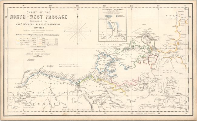
This scarce chart depicts Sir John Franklin's infamous lost expedition in the Canadian Arctic, as well as the subsequent expeditions to locate Franklin and his crew. In 1845, Franklin set out to find the Northwest Passage with 134 men in two ships, Erebus and Terror. They were last seen in July 1847 waiting to enter the ice of Baffin Bay. Lady Franklin was politically connected and encouraged an extensive search for her husband. No fewer than 32 vessels were sent out by England to search for them and it was not until 1854 that the first clues emerged as to the fate of the expedition. The chart lists nine of the parties and uses color-coding to identify the areas that each party explored. The track of HMS Investigator Captain McClure is outlined, and the discoveries of each of the expeditions are noted throughout the chart. This is the third edition of this map, and includes a new inset map of the discoveries of Lieutenant De Haven in September 1850 in Wellington Channel. This chart was based on Admiralty charts, and was the first commercially-produced chart to depict the new discoveries in the Arctic and the actual Northwest Passage.
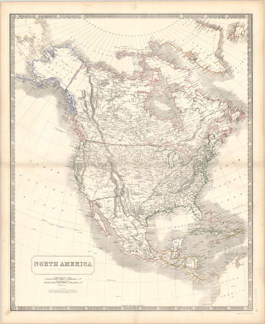
On verso is a double-page map, North America (19.8 x 24.1"), which shows the boundary between the United States and Mexico along the Rio Grande and Gila River. There is limited detail in the American Southwest, which is noted as Upper or New California.
References:
Condition: B+
A nice impression with contemporary outline color and light soiling, mostly visible in the blank margins. The map of North America also has contemporary outline color, minor soiling, and light toning along the edges of the sheet.