Catalog Archive
Auction 197, Lot 12

"Il Mappamondo o sia Descrizione Generale del Globo Ridotto in Quadro", Zatta, Antonio
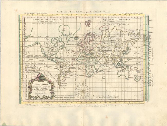
Subject: World

Period: 1774 (dated)

Publication: Atlante Novissimo

Color: Hand Color

Size:
16 x 10.7 inches
40.6 x 27.2 cm
Download High Resolution Image
(or just click on image to launch the Zoom viewer)

This attractive Italian map, presented on Mercator's projection, delineates the voyages of Cook and Bougainville. Greenland is shown connected to North America, and Alaska is considerably oversized. Terra di van Diemen is part of the Australian mainland, and New Zealand appears as two islands, albeit in an unusual stout configuration. The map is decorated with a garland-style title cartouche and a nice compass rose. The map is surrounded by information on time zones, climate, and the lengths of the days and nights.

References: Shirley (BL Atlases) T.ZAT-1a, Vol. 1 #6.

Condition: A

On a sturdy sheet with the watermarks of a coat of arms and three crescent moons. There is a hint of toning along the centerfold and marginal soiling.

Estimate: $475 - $600

Unsold

Closed on 4/24/2024

Archived