"Amerique Septentrionale, Dressee, sur les Relations les Plus Modernes des Voyageurs et Navigateurs, et Divisee Suivant les Differentes Possessions des Europeens", Robert de Vaugondy, Didier
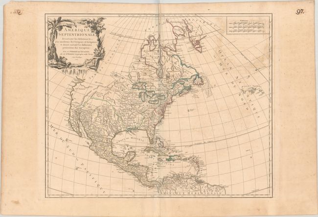
This handsome map of the continent shows the colonial possessions with interesting configurations. There are numerous Indian names throughout the Mississippi River valley and the Spanish possessions in New Mexico, while the rest of the western region is largely blank. In the Pacific Northwest, the Entrée decouvert par Martin d'Aquilar alludes to a possible Northwest Passage. The large title cartouche features a river, Native Americans and a crocodile. This is the second state with a frame added around the distance scales and several place names added in Canada.
References: Pedley #448.
Condition: B+
A nice impression with contemporary outline color on a lightly toned sheet with a chapel watermark. There is light offsetting, a few small spots, and a printer's crease and extraneous crease along the centerfold at top.