Catalog Archive
Auction 193, Lot 67
"Hemisphere Occidental du Globe Tertre Veu en Convexe l'Oeil Etant Infiniment Distant et Vis a Vis la Section...", Moullart-Sanson, Pierre
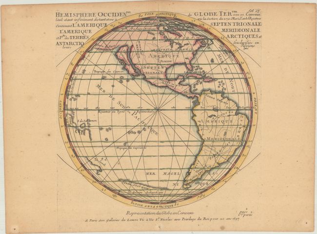
Subject: Western Hemisphere - America
Period: 1697 (dated)
Publication:
Color: Hand Color
Size:
8.5 x 8.3 inches
21.6 x 21.1 cm
Download High Resolution Image
(or just click on image to launch the Zoom viewer)
(or just click on image to launch the Zoom viewer)