Catalog Archive
Auction 192, Lot 90

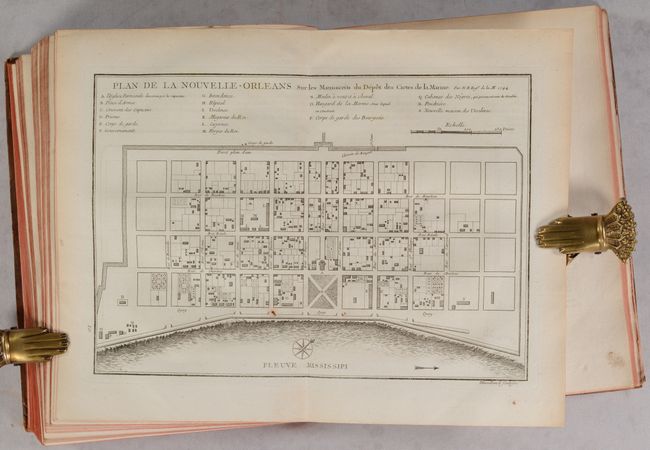
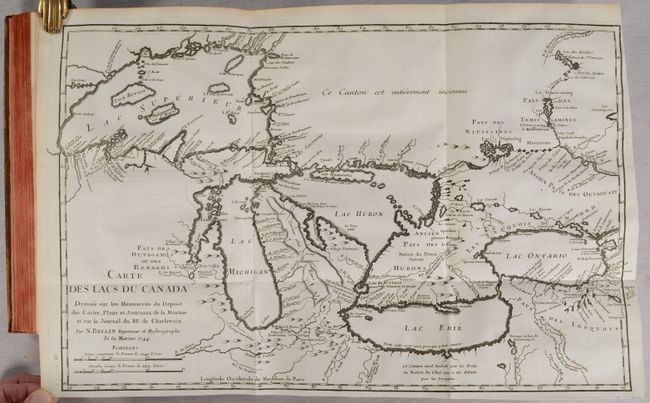
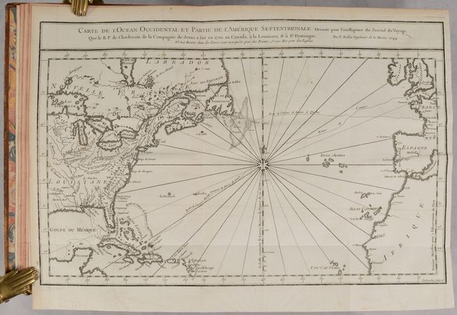
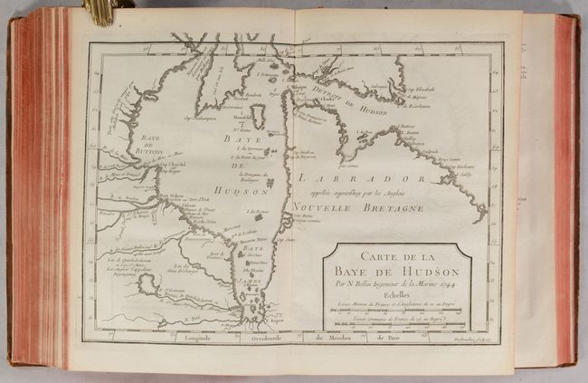
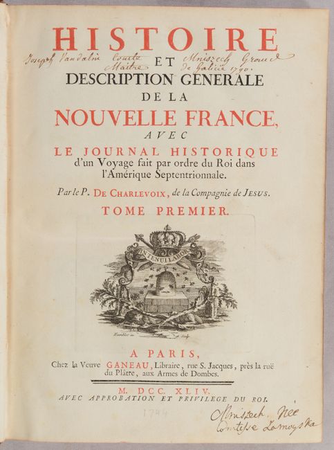
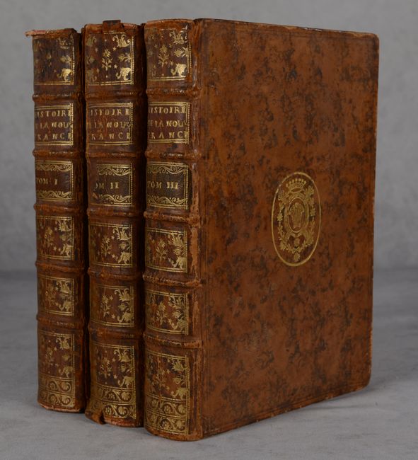
Important Account of French Possessions in Colonial North America with 28 Maps

"[3 Volumes] Histoire et Description Generale de la Nouvelle France, avec le Journal Historique d'un Voyage fait par Ordre du Roi dan l'Amerique Septentrionale...", Charlevoix, P. F. Xavier de

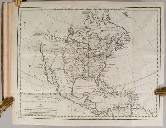
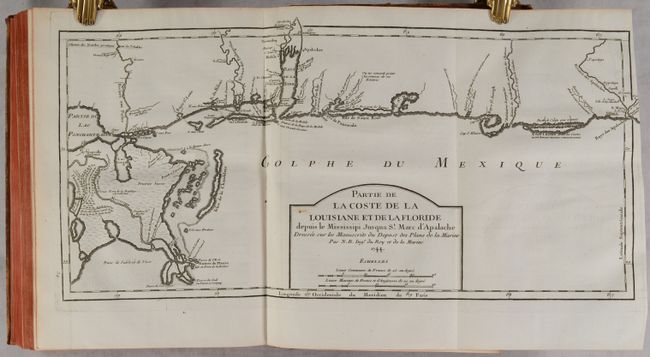
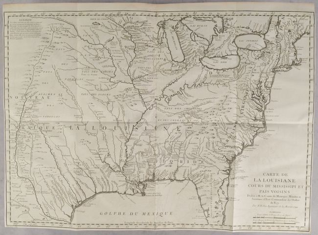
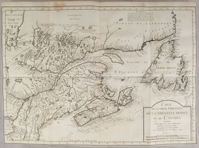
Subject: Colonial North America

Period: 1744 (published)

Publication:

Color: Black & White

Size:
7.8 x 10.3 inches
19.8 x 26.2 cm
Download High Resolution Image
(or just click on image to launch the Zoom viewer)

Pierre Francois Xavier de Charlevoix was a Jesuit Priest who traveled through the French possessions of North America from 1720-1722. He brought manuscript sketches back to Paris and published an account on his travels with 28 maps and 44 botanical plates. This is Charlevoix's largest historical work and is considered one of the best works on Canada, Louisiana and French Florida of the time period. This account was extremely influential in future decisions made by Thomas Jefferson with regard to the Louisiana Purchase and the exploration of the west. The work includes important maps by Bellin of North America, the Great Lakes, Louisiana, Florida, New Orleans, and others. Most of the maps are dated 1744, with the exception of the map of North America, which is dated 1743. The maps are:

1. Carte de l’Amerique Septentrionale
2. Carte des Lacs du Canada
3. Carte de la Louisiane Cours du Mississipi et Pays Voisins
4. Carte de la Partie Orientale de la Nouvelle France ou du Canada
5. Plan de la Nouvelle-Orleans
6. Carte de l’Ocean Occidental et Partie de l’Amerique Septentrionale
7. Partie de la Coste de la Louisiane et de la Floride
8. Carte des Costes de la Floride Francoise
9. Carte du De’troit Entre le Lac Superior et le Lac Huron
10. Carte des Embouchures du Mississipi
11. Plan de la Baye de Pensacola
12. Carte de l’Accadie
13. Carte de la Riviere de Richelieu et du Lac Champlain
14. Carte de l’Isle de Montreal et de ses Environs
15. Carte des Bayes, Rades et Port de plaisance dans l’Isle de Terre Neuve
16. Carte de l’Isle de Terre Neuve
17. Carte du Fonds de la Baye de Hudson
18. Carte de la Baye de Hudson
19. Plan du Port Royal dans l’Accadie
20. Plan du Port de la Haive…Accadie
21. Plan de la Baye de Chedabouctou Aujourd’hui Havre du Milfort
22. Carte de l’Isle Royale
23. Plan du Port et Ville de Louisbourg
24. Plan du Port Duaphin … l”engree de Labrador
25. Carte du Cours de la Riviere du Sageunay
26. Carte de l’Isle d’Orleans
27. Plan du Bassin de Quebec
28. Plan de la Ville de Quebec

This work was published in 1744 in both a 3-volume quarto edition and a 6-volume duodecimo edition. Quarto; three volumes with 28 maps and plans (26 folding), and 44 engraved plates on 22 folding sheets. Volume I: viii, xxvi, 664 pp. Volume II: xv, 582 pp, 56 pp. Volume III: xix, xiv, 543 pp. Full contemporary speckled calf with gilt embossed coat of arms on front covers; raised bands with gilt decorations and leather title labels on spines; marbled endpapers and all edges red.

References: Howes #C-307; Sabin #12135; Shirley (BL Atlases) G.CHAR-3a.

Condition: B+

The maps have nice impressions with light offsetting on some. The map of the North Atlantic has some dampstains at top. The text has light, occasional foxing and toning. The text at the end of Volume II is coming loose. The title pages have old manuscript ink notations from previous owners. The covers show light wear with bumped corners and some small abrasions, and are beginning to split from the spines in several spots. The spines have some abrasions and cracking. Overall a very sound set.

Estimate: $5,500 - $7,000

Sold for: $4,750

Closed on 4/26/2023

Archived