Catalog Archive
Auction 192, Lot 47

"The Physical Features of Europe & Asia, Showing the Mountains, Table-Lands, Plains & Slopes", Johnston, W. & A.K.

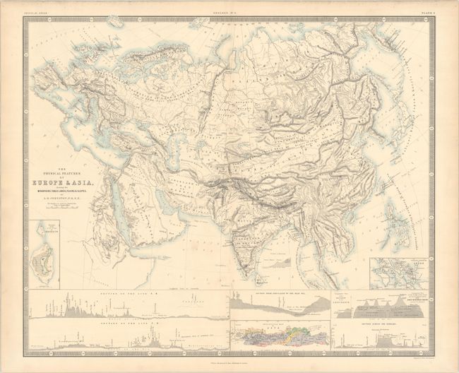
Subject: Europe & Asia

Period: 1854 (circa)

Publication: The Physical Atlas of Natural Phenomena

Color: Printed Color

Size:
24.3 x 20.2 inches
61.7 x 51.3 cm
Download High Resolution Image
(or just click on image to launch the Zoom viewer)

This thematic map focuses on the geographical features of Europe and Asia, with good detail of the mountains and rivers. The insets at bottom left show relative elevations of two lines drawn on the map and marked A-B (from the Bay of Biscay to the Caspian Sea) and C-D (from the Arctic Ocean to the Mediterranean). Other insets show comparative heights of mountains, a geological map of Java, and a cross section of the Himalayas.

Keith Johnson worked in conjunction with German Heinrich Berghaus to produce the Physical Atlas, the first truly comprehensive thematic atlas. The maps from this atlas were early examples of printed color and made a huge impact on cartography in general and specifically on the graphic portrayal of geographical data.

References: Robinson, pp. 64-75.

Condition: A

A bright sheet with minor toning along the edges.

Estimate: $110 - $140

Sold for: $80

Closed on 4/26/2023

Archived