Catalog Archive
Auction 191, Lot 836

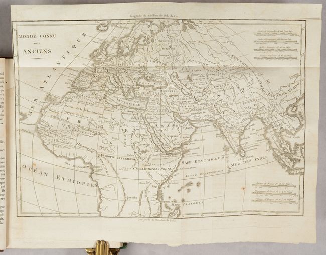
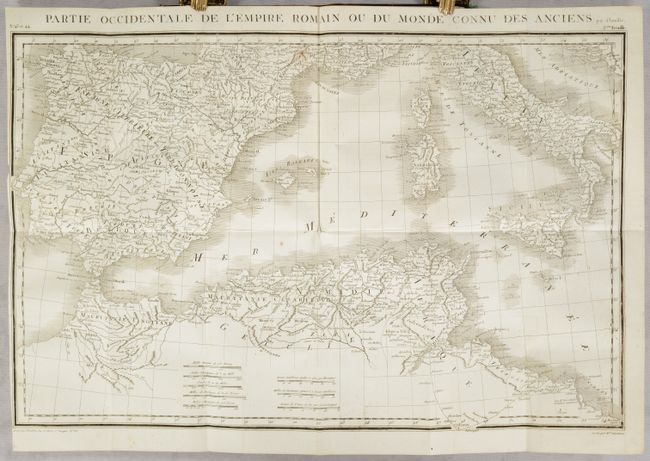
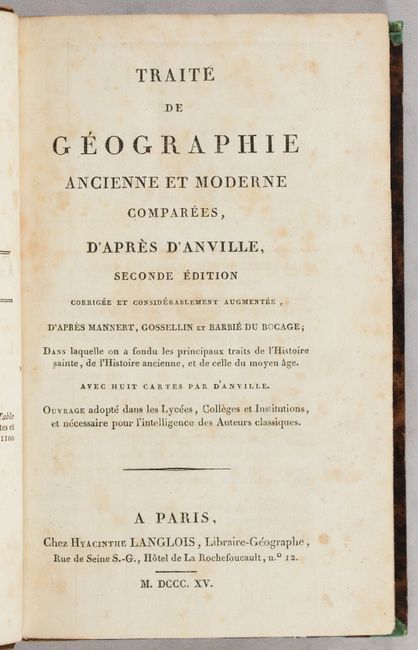
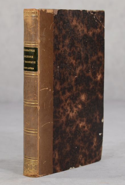
"Traite de Geographie Ancienne et Moderne Comparees...", Anville, Jean Baptiste Bourguignon d'

Subject: Geography Books

Period: 1815 (published)

Publication:

Color: Black & White

Size:
5.3 x 8.4 inches
13.5 x 21.3 cm
Download High Resolution Image
(or just click on image to launch the Zoom viewer)

This is the second edition of Hyacinthe Langlois' book of ancient and modern geography based on the work of Mannert, Gossellin and Barbie du Bocage, with 8 maps by D'Anville. The maps are all folding maps and relate to ancient geography:

A. Monde Connu des Anciens (12.4 x 8.4")
B. Carte de la Terre-Sainte Contenant les Douze Tribus d'Israel (8.7 x 12.7")
C. Carte de l'Expedition d'Alexandre (16.8 x 9.9")
D. Partie Orientale de l'Empire Romain .. 2eme Feuille (21.2 x 13.8") (northern Africa & Middle East)
E. Partie Orientale de l'Empire Romain ... 1re Feuille (21.2 x 13.8") (Black Sea & Balkans)
F. Partie Occidentale de l'Empire Romain ... 1ere Feuille (21.2 x 13.8") (western Europe)
G. Partie Occidentale de l'Empire Romain ... 2eme Feuille (21.2 x 13.8") (southern Europe)
H. Italie Ancienne (8.3 x 10.7")

12mo. 248 pages; 8 folding maps; index; errata. Hardbound in quarter tan leather over brown marbled paper-covered boards; gilt tooling and black leather title label on spine; marbled end papers; original green ribbon page marker.

References:

Condition: B+

The maps are in very good condition and have minor soiling and offsetting. The text has light scattered foxing. The covers have bumped corners with some small abrasions and light wear. The spine is lightly rubbed.

Estimate: $350 - $425

Sold for: $200

Closed on 2/8/2023

Archived