Catalog Archive
Auction 191, Lot 818

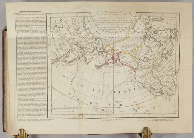
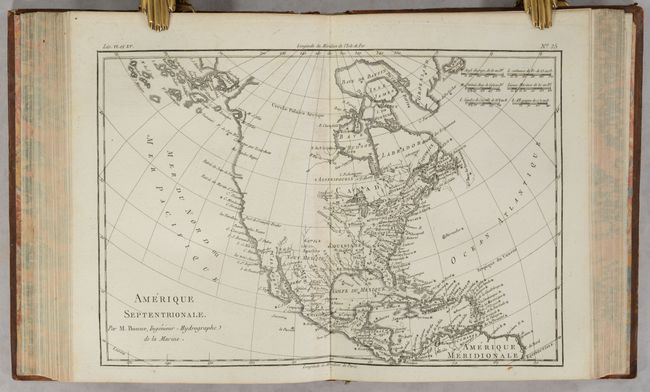
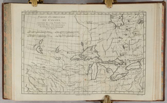
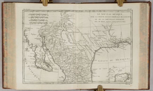
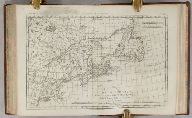
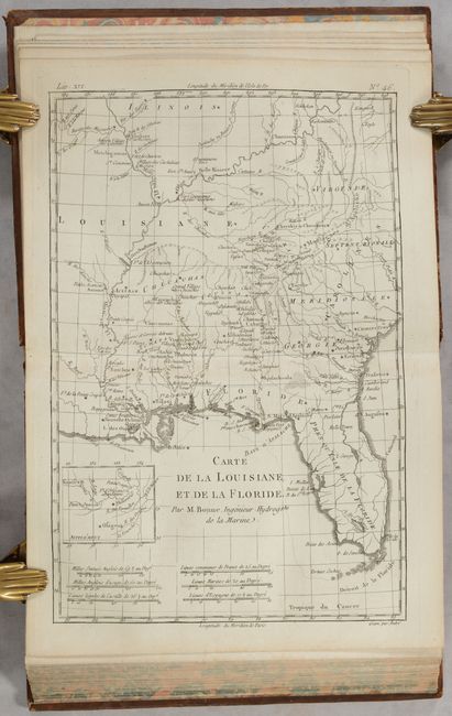
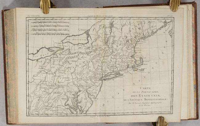
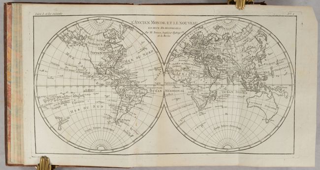
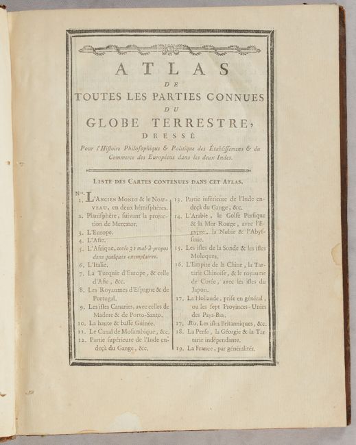
Unique Edition of Raynal's Atlas with Rare Map of North Pacific Ocean

"Atlas de Toutes les Parties Connues du Globe Terrestre...", Bonne/Raynal

Subject: Atlases

Period: 1781 (published)

Publication:

Color: Black & White

Size:
8.3 x 10.2 inches
21.1 x 25.9 cm
Download High Resolution Image
(or just click on image to launch the Zoom viewer)

This is the atlas volume for Abbe Raynal's L'Histoire Philosophique et Politique des Etablissemens et du Commerce des Europeens dans les Deux Indes. The atlas is complete and is filled with Bonne's well-drawn maps and charts engraved by Andre and Dien. Included are a list of maps, Analyse Succincet de l'Atlas (28 pages), Arrest de la Cour de Parlement (14 pages), and 51 double-page maps, two of which are folding. Although the atlas volume did not carry any publication information on the title page, this example has the additional Arrest de la Cour de Parlement, which is dated 1781 and includes the publisher's imprint of P. G. Simon in Paris. The map contents include two world maps, North America, South America, Europe, Asia, and Africa. There are also regional maps, including nine related to Europe, eight related to Africa, eight related to Asia, six related to South America, and fifteen related to North America. The notable North American regional maps are: Partie Occidentale du Canada; Le Nouveau Mexique; L'Isle de Terre-Neuve, l'Acadie; Carte de la Louisiane, et de la Floride; Carte de la Partie Nord des Etats Unis; and Carte de la Partie Sud des Etats Unis.

In the map of North America, the entire western part of the continent is left mostly blank. Indian tribes, such as the Apaches, Sioux, Outagamis, and Assenipouels, occupy the edges of defined territory. The British Colonies and a few major cities are named along the eastern seaboard and in the Great Lakes region. Alaska is shown as a group of islands, the largest of which is labeled Alaschka.

This volume includes an additional map not listed in the table of contents and not typically found in this atlas: Nouvelle Carte de la Partie Septentrionale du Globe, Comprise Entre le Kamtchatka et la Californie by Buache and Dezauche and dated 15 November 1781. This handsome small map is centered on the North Pacific Ocean and extends to show the majority of North America. The map was created to reconcile Juan de Fuca and Admiral de Fonte's discoveries with Captain Cook's third voyage (1776-79) through the North Pacific Ocean. A small remnant of the Sea of the West, which had long been championed by Philippe Buache, appears between Qui and Vira. Further north there is a large lake named Lac de Fuentes, which nearly connects the Pacific Ocean to Hudson Bay. Cook's route is depicted, and a block of text at left describes his voyage. This map is quite rare.

Hardbound in full contemporary mottled calf with gilt tooling on covers and spine; raised bands on spine with black and red leather title labels; marbled end papers; and all edges marbled.

References:

Condition: B+

The maps have dark impressions, resulting in light printer's ink residue and offsetting on some of them. The world map has an archivally repaired tear in the Eastern Hemisphere, and a few maps have minor soiling. The Buache/Dezauche map has contemporary outline color and several small stains at bottom. The text has minor toning. The covers have bumped corners, light rubbing and a few small abrasions. The spine is also lightly worn and rubbed. Overall a very nice example of this atlas.

Estimate: $1,500 - $1,800

Sold for: $1,300

Closed on 2/8/2023

Archived