Catalog Archive
Auction 191, Lot 774

"Western Australia Containing the Settlements of Swan-River and King George's Sound... [on sheet with] Van-Diemen Island", SDUK Society for the Diffusion of Useful Knowledge

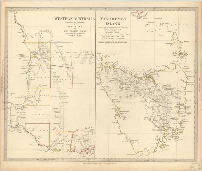
Subject: Western Australia & Tasmania

Period: 1833 (dated)

Publication:

Color: Hand Color

Size:
15.5 x 12.4 inches
39.4 x 31.5 cm
Download High Resolution Image
(or just click on image to launch the Zoom viewer)

The beginning of the nineteenth century saw a period of rapid market growth and innovation in the map publishing world. Increased literacy and public interest in new frontiers and colonies overwhelmed the market because it was oriented toward the small, affluent market of the previous century. With the intent to fill this void, The Society for the Diffusion of Useful Knowledge (SDUK) was founded in 1828 in London, by Lord Brougham and a group of men dedicated to the education of the aspiring working class and the Utilitarian ideal of 'Knowledge is Power.' The society produced an array of education materials, but the series of maps was one of their most successful ventures. A number of engravers and printers were used to produce the maps, which eventually exceed 200 sheets, and continued to be published after the Society as a whole ceased to function.

Two fine maps on one sheet, showing harbors around all coastlines and topographical details in inland regions for both Western Australia and Tasmania. Western Australia covers the area from Perth and the settlements along the Swan River, to St. George's Sound. The adjacent map covers all of Tasmania and the Bass Strait, with numerous place names identified, including Hobart Town on the southeast coast. Engraved by J. & C. Walker. This is the first edition, published by Baldwin & Craddock.

References: Tooley (Australia) #1176.

Condition: A

Contemporary outline color with light toning along the edges of the sheet.

Estimate: $120 - $150

Sold for: $50

Closed on 2/8/2023

Archived