Catalog Archive
Auction 191, Lot 769

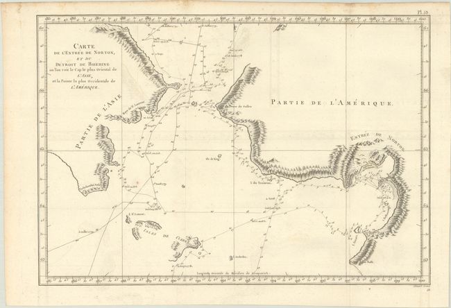
"Carte de l'Entree de Norton, et du Detroit de Bhering ou l'on Voit le Cap le Plus Oriental de l'Asie, et la Pointe la Plus Occidentale de l'Amerique", Cook/Benard

Subject: Bering Strait

Period: 1785 (circa)

Publication: Troisieme Voyage de Cook, ou Voyage a l'Ocean Pacifique…

Color: Black & White

Size:
15.3 x 10.6 inches
38.9 x 26.9 cm
Download High Resolution Image
(or just click on image to launch the Zoom viewer)

Captain James Cook (1728-1779) is best known for his three voyages to the Pacific (1768-71; 1772-75; and 1776-79). His discoveries radically changed the western understanding of the world in the late 18th century. He was the first to circumnavigate and chart New Zealand and provided the earliest European accounts of exploration along the eastern coast of Australia and the Hawaiian Islands. On February 14th, 1779, he was killed on Hawaii after attempting to kidnap the chief of the island.

Many contemporary accounts of Cook’s voyages, including charts and engravings, appeared in the late 18th century. The first official account of Cook’s first voyage was published in 1773 by John Hawkesworth in Volumes II and III of An Account of the Voyages Undertaken by the Order of His Present Majesty for Making Discoveries in the Southern Hemisphere... William Strahan and Thomas Cadell published the first official accounts of the second and third voyages in 1777 and 1784. Accounts of his exploration were subsequently translated into French, German, and Dutch.

French edition of this map from the expedition of Capt. James Cook. It covers the Bering Strait from south of Norton Sound to north of Cap du Prince de Galles and the corresponding coastline of Russia. Features include hachures representing coastal mountains, islands, place names, and soundings. St. Lawrence Island and Isles de Clerke are partially shown. It delineates the tracks of both the 1778 Cook expedition and the 1779 Clerke exploration undertaken after Cook's death in Hawaii in February 1779.

References: Shirley (BL Atlases) G.COOK-4a #15.

Condition: B+

Issued folding on watermarked paper with light offsetting and a bit of foxing mostly in the top blank margin.

Estimate: $140 - $170

Sold for: $70

Closed on 2/8/2023

Archived