Catalog Archive
Auction 191, Lot 743

NO RESERVE

"Carte de la Barbarie de la Nigritie et de la Guinee", Delisle, Guillaume

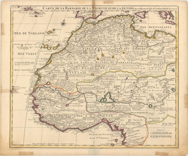
Subject: Northwestern Africa

Period: 1750 (circa)

Publication:

Color: Hand Color

Size:
22.7 x 19.3 inches
57.7 x 49 cm
Download High Resolution Image
(or just click on image to launch the Zoom viewer)

Deftly engraved 18th century map of western Africa from Barbary, Nigeria, and Guinea to below the equator. There is a mass of geographic detail and notations in the interior with information on the rivers and lakes. Numerous tent encampments are depicted throughout the Sahara Desert. A note at the eastern end of the Niger River explains that some believe that the Niger is an "arm of the Nile."

References: Norwich #317.

Condition: B

A sharp impression with contemporary outline color. There are short centerfold separations at top and bottom as well as a few short tears along the edges of the sheet that have been closed on verso with non-archival tape, causing some tape stains on recto.

Estimate: $100 - $130

Sold for: $60

Closed on 2/8/2023

Archived