Catalog Archive
Auction 191, Lot 682

NO RESERVE

"Mount Everest and the Group of Chomo Lungma",

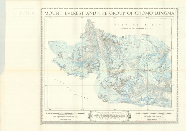
Subject: Tibet, Nepal

Period: 1934 (dated)

Publication:

Color: Printed Color

Size:
21.9 x 18.5 inches
55.6 x 47 cm
Download High Resolution Image
(or just click on image to launch the Zoom viewer)

This detailed map of the Mount Everest region presents a landscape covered in glaciers (blue shading) with only mountain peaks consisting of rock. Numerous peaks are located including Everest (Chomolungma in Tibetan), Nuptse, Lhotse and more with corresponding heights listed in both meters and feet. Red overprinting indicates the route taken in 1933 with additional camps located along the way (the British had three previous failed attempts in the early 1920s). A legend at bottom further identifies triangulated points, camera stations, intersection points, and contour lines for both land (black) and glacier (blue). Drawn by Charles Facot-Guillarmod based upon surveys of Major Wheeler and Hari Singh. First issued for the Mount Everest Committee of the Royal Geographical Society and Alpine Club by the Ordnance Survey after the 1924 attempt. This second edition of the map reflects the 1933 attempt. Edmund Hillary and Tenzing Norgay were the first to successfully ascend Everest in 1953.

References:

Condition: A

Issued folding on a bright sheet with some minor offsetting.

Estimate: $100 - $130

Sold for: $140

Closed on 2/8/2023

Archived