Catalog Archive
Auction 191, Lot 626

One of the Most Decorative 17th Century Maps of Malta

"Insula Malta Accuratissime Delineata, Urbibus, et Fortalitiis", Wit, Frederick de
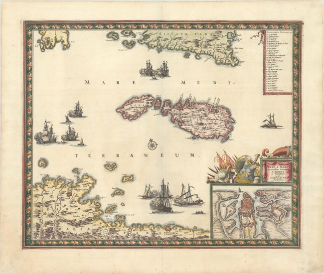
Subject: Malta

Period: 1680 (circa)

Publication:

Color: Hand Color

Size:
21.3 x 17.5 inches
54.1 x 44.5 cm
Download High Resolution Image
(or just click on image to launch the Zoom viewer)

This superb map shows the strategic location of Malta between Sicily and the northern coast of Africa where the fortified cities of Tunis and Tripoli are highlighted. A large inset shows the extensive fortifications of Valleta that were built by the famous Knights of Malta after the Siege of Malta. Three sea battles are depicted in the Mediterranean and a key identifies the important sites. The title cartouche is festooned with implements of war and a beautiful, picture-frame style border encloses the map.

References:

Condition: A

A sharp impression on a bright sheet with professionally repaired centerfold separations at top and bottom and a minor crease at left.

Estimate: $1,100 - $1,400

Sold for: $700

Closed on 2/8/2023

Archived