Catalog Archive
Auction 191, Lot 220

Features Maps of Yellowstone

"[3 Maps in Report] Sixth Annual Report of the United States Geological Survey of the Territories, Embracing Portions of Montana, Idaho, Wyoming, and Utah...", Hayden, Ferdinand Vandeveer

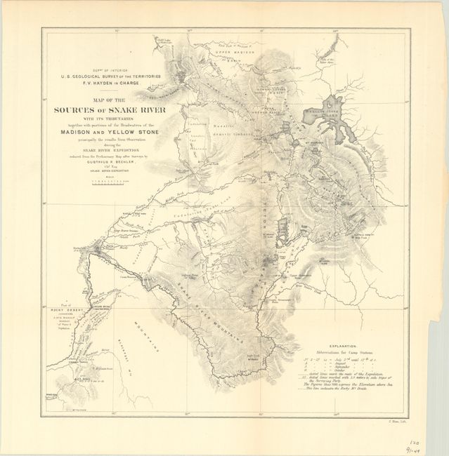
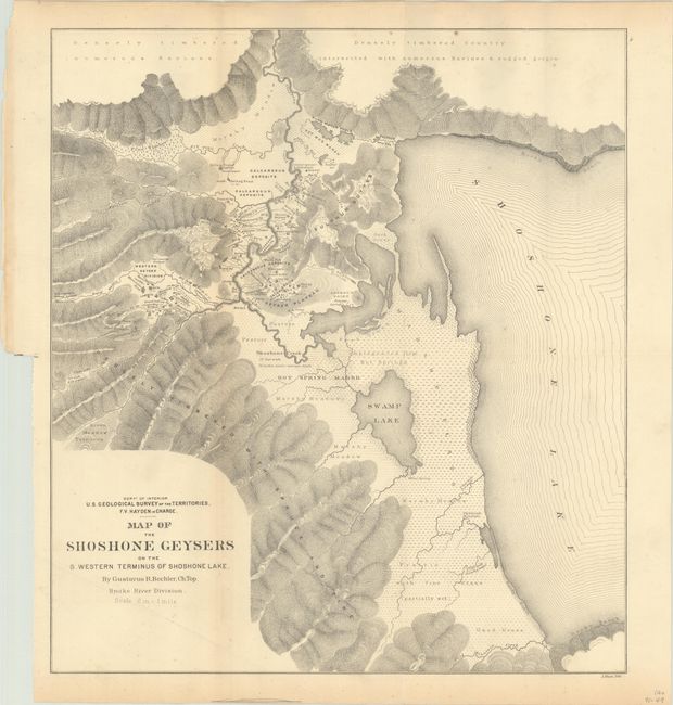
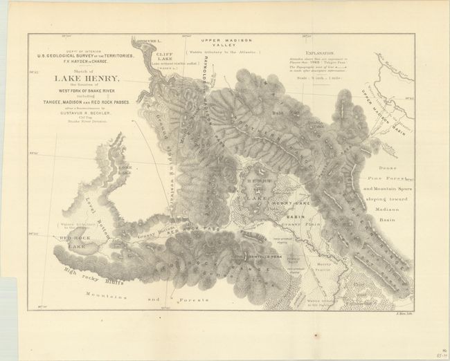
Subject: Western United States

Period: 1873 (published)

Publication:

Color: Black & White

Size:
6 x 9.2 inches
15.2 x 23.4 cm
Download High Resolution Image
(or just click on image to launch the Zoom viewer)

This report focuses on the territories of Montana, Idaho, Wyoming and Utah and is divided into four parts: Hayden's geological report, special reports on geology and paleontology, special reports on zoology and botany, and reports on astronomy and hypsometry. Included are 5 maps (three of which are folding), 12 paleontological plates, and numerous engravings within the text. The three folding maps are:

Map of the Sources of Snake River with Its Tributaries Together with Portions of the Headwaters of the Madison and Yellow Stone... (9.9 x 10.3"). Shows northern Wyoming and the Yellowstone area drawn during Hayden's Geological Survey of 1871. This area later became Yellowstone National Park in 1872 and Hayden's surveying efforts were a significant factor in Congress' decision to create the park. The map shows Yellow Stone Lake, Jackson's Lake, the Snake River and relief through hachure.

Map of the Shoshone Geysers on the S. Western Terminus of Shoshone Lake (13.8 x 15.5"). This topographical map shows the region to the west of Shoshone Lake in Yellowstone National Park. The region is known as the Shoshone Geyser Basin and contains one of the highest concentrations of geysers in the world. There is excellent detail of the geysers, springs, pools, and waterways in the area. Created by Gustavus R. Bechler. Lithographed by Julius Bien.

Sketch of Lake Henry, the Sources of West Fork of Snake River including Tahgee, Madison and Red Rock Passes (11.8 x 8.4"). This map of Henrys Lake, Idaho, gives good detail of the topography and drainage in the region.

844 pp. Octavo, hardbound in brown cloth with gilt titling on spine.

References: Blevins #238; cf. Wheat #1233.

Condition: B+

The folding maps are very good to near fine, with the Shoshone Geyers map having some minor foxing and a faint crease at lower left. Text and plates have a hint of pleasant light toning. Covers have light wear with bumped corners.

Estimate: $240 - $300

Sold for: $180

Closed on 2/8/2023

Archived