Catalog Archive
Auction 191, Lot 1

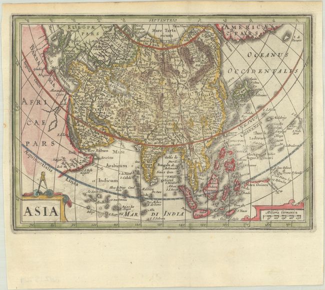
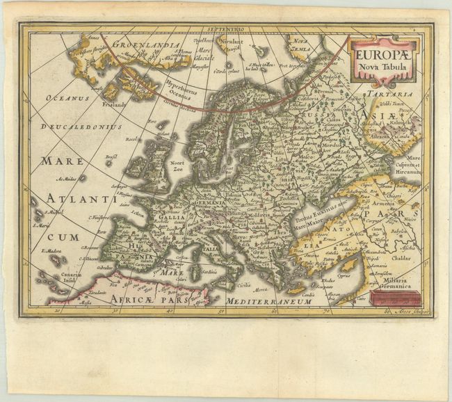
"[Lot of 5] Typus Orbis Terrarum [and] Americae Descriptio [and] Africae Descriptio [and] Asia [and] Europae Nova Tabula", Cluver/Jansson

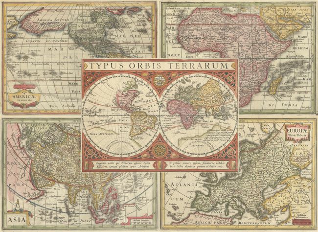
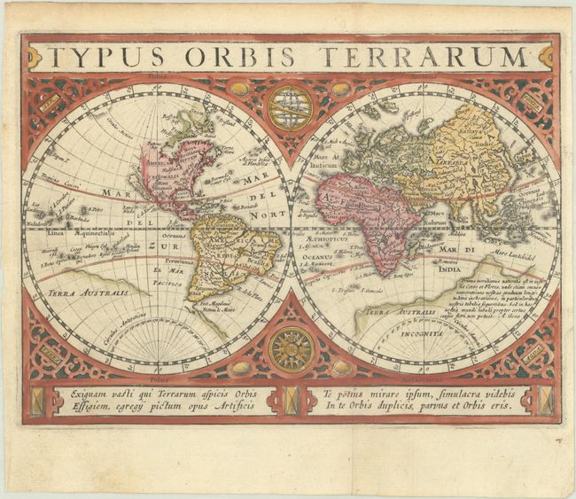
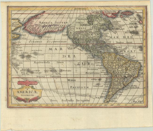
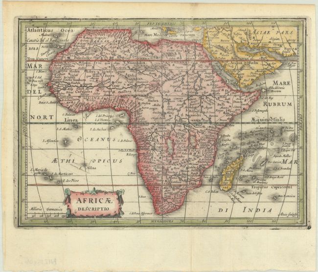
Subject: World & Continents

Period: 1661 (published)

Publication: Introductionis in Universam Geographiam

Color: Hand Color

Size:
8 x 5.8 inches
20.3 x 14.7 cm
Download High Resolution Image
(or just click on image to launch the Zoom viewer)

Beautifully engraved, matched set of maps featuring the world and continents originally engraved by Abraham Goos in 1628 for Jansson's editions of the Atlas Minor and then published in this edition of Cluver's popular geography. This interesting set is illustrative of the fluctuating theories prevalent during this period of discovery. Size varies slightly. Blank versos.

A. Typus Orbis Terrarum is a beautiful double hemisphere world map surrounded in strapwork borders into which are set an armillary sphere and a compass rose. The map features the island of California with no coastline continuing to the northwest. Terra Australis has a broken coastline and a notation that ends with the signature of the engraver, A. Goos. Four lines of Latin text balance the title cartouche at bottom. Ref: Shirley #325; Van der Krogt (Vol. III) #0001:352.1.

B. The most dominant feature of Americae Descriptio is the curious depiction of the west coast of North America, which is completely bisected by an unnamed strait hinting at a Northwest Passage. The bulging northwest coast of North America continues another 65 degrees and is separated from Asia by a narrow Fretum Anian and California is shown as a peninsula. These features were derived from the Van den Keere and Plancius globe of 1614 and this is the first time they appear on a map of the Americas. Previous maps had depicted the supposed Northwest Passage through the Strait of Anian. Other interesting features include the St. Lawrence River flowing from a small lake in the west, no Great Lakes, and an area of shading in Virginia alluding to the possibility of a Verrazano-type inland sea. In the southern hemisphere, two large mythical lakes appear in South America, Tierra del Fuego is only partially delineated, and there is a massive southern continent (Terra Australis Incognita). Ref: Burden #221; Van der Krogt (Vol. III) #9000:352.1.

C. Africae Descriptio is based largely on the work of Hernicus Hondius and incorporates information from Bleau’s map of 1617, especially on the river systems. Though smaller in size, the map includes more place names than Hondius' 1607 folio map of the continent, and continues with the typical antiquated geography of the sixteenth and early seventeenth centuries. Ref: Betz #64.1; Van der Krogt (Vol. III) #8600:352.1.

D. Asia is a small version of Hondius' important map of the continent and the East Indies. Korea appears as an island, an exaggerated Gulf of Cambay distorts the Indian subcontinent, the southern coastline of Java is blank, and in the extreme east is Americae Pars. Strapwork title and scale of miles cartouches. Although engraved by Goos, this strongly resembles Pieter van den Keere's configuration with Japan on the Teixeira model and the island of Korea, here called Cory. Ref: Yeo #21; Van der Krogt (Vol. III) #8000:352.1.

E. Europae Nova Tabula is a fine small map of the continent extending to include Greenland and Iceland. The map shows the Arctic discoveries of Willem Barents in his quest to find a Northeast Passage to Asia. Ref: Van der Krogt (Vol. III) #1000:352.1.

References:

Condition: A

Nice impressions on bright sheets with marginal soiling and minor toning along the edges of the sheets. The maps of the Americas and Africa have a bit of printer's ink residue, and the map of the Americas also has minor soiling in the image.

Estimate: $2,200 - $2,500

Sold for: $1,600

Closed on 2/8/2023

Archived