Catalog Archive
Auction 191, Lot 191

Covens & Mortier's Map of the Southeast Issued During the French and Indian War

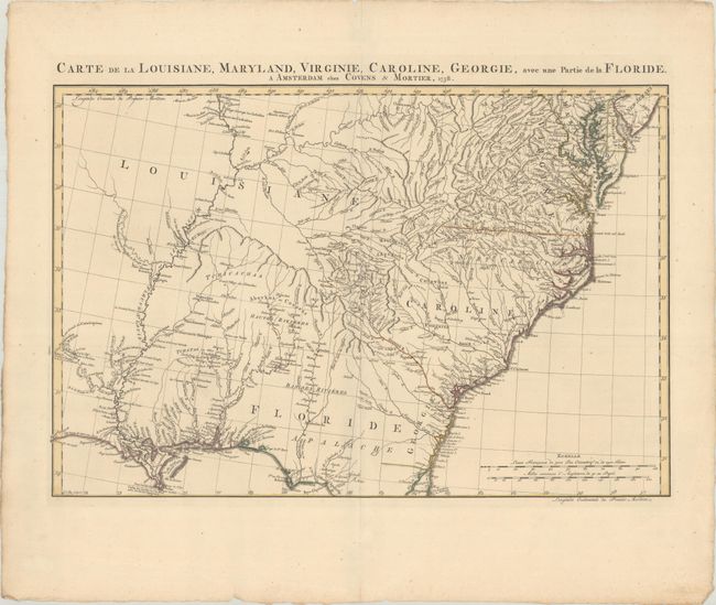
"Carte de la Louisiane, Maryland, Virginie, Caroline, Georgie, avec une Partie de la Floride", Covens & Mortier
Subject: Colonial Southeastern United States

Period: 1758 (dated)

Publication:

Color: Hand Color

Size:
23.3 x 15.4 inches
59.2 x 39.1 cm
Download High Resolution Image
(or just click on image to launch the Zoom viewer)

This scarce and detailed map of the Southeast covers from Delaware Bay to St. Augustine and inland to include the Mississippi valley and Natchitoches. French Louisiane occupies the country west of the Appalachians, and the conflicting claims of Britain and Spain are shown in the region of Georgia and Florida. The Granville Line is delineated in North Carolina, but the division between the Carolinas is not depicted. Numerous Indian villages are located throughout the map. The map was engraved by Jan Christian Sepp and is based on D'Anville's "Canada Louisiane et Terres Angloises" (1755).

References: Cumming (SE) #316; Sellers and Van Ee #1386.

Condition: A

A fine impression on a sheet with the watermark of Dutch papermaker "C & I Honig" with contemporary outline color. There are short centerfold separations confined to the top and bottom blank margin that have been closed on verso with archival tape.

Estimate: $1,100 - $1,400

Sold for: $1,500

Closed on 2/8/2023

Archived