Catalog Archive
Auction 191, Lot 169

"Map of the United States of America", Carey, Mathew

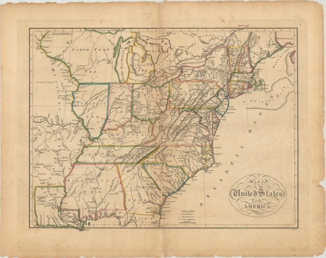
Subject: Eastern United States

Period: 1814 (circa)

Publication: Carey's General Atlas

Color: Hand Color

Size:
17.3 x 13.2 inches
43.9 x 33.5 cm
Download High Resolution Image
(or just click on image to launch the Zoom viewer)

Mathew Carey was a seminal figure in early American publishing; establishing the first publishing firm to specialize in cartography and issuing the first atlas devoted exclusively to American maps. He set up an elaborate cottage system of craftsmen for compiling, engraving, printing, and coloring maps. This practice was emulated by later American cartographic publishers such as John Melish and Henry S. Tanner. The American Atlas concept was also adopted by other publishers in both the United States and Europe.

This map of the young United States extends just beyond the Mississippi River. The mid-western territories are a bit misaligned with Indiana shown directly below Lake Michigan and Chicago appearing in North West Territory. West of the Mississippi River is the large Missouri Territory stretching northwards from Louisiana. Major roads with distances, proposed canals, cities, forts, and Indian villages are among the interesting details illustrated on the map.

A notation of Yazoo Speculation in Mississippi refers to the Yazoo Land Fraud perpetrated in 1789-1796 when the region was part of Georgia Territory. Three companies bribed and intimidated a bill through the Georgia assembly that allowed them to purchase millions of acres of land for next to nothing, resulting in a huge public outcry. The bill's supporters were swiftly voted out of power, and Senator James Jackson took office. He vowed to repeal the Yazoo Act if it cost him his life, saying he would repeal it even if he had to shoot everyone involved in passing it. He didn't have to shoot anyone, and the law was rescinded in 1796. The fact it is shown on a map produced many years later attests to the importance attributed to this fraudulent scheme.

References: Phillips (Atlases) #1372-5.

Condition: B

The map was completely separated along the centerfold and skillfully rejoined with archival tape. There is a bit of loss along the lower centerfold, light toning, minor foxing, and small chips and tears along the edges of the sheet.

Estimate: $450 - $550

Sold for: $475

Closed on 2/8/2023

Archived