Catalog Archive
Auction 191, Lot 140

"[19 Maps in Report] Boundary Between the United States and Great Britain. Message from the President of the United States...", U.S. Government

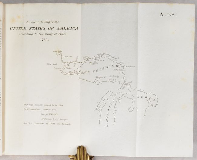
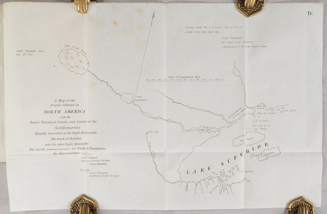
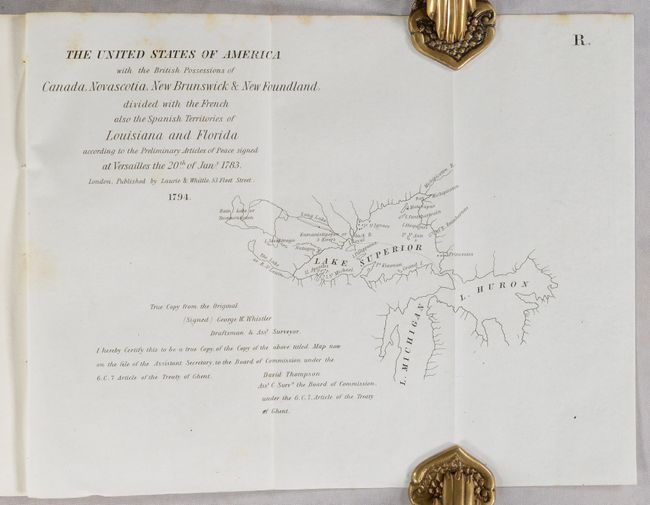
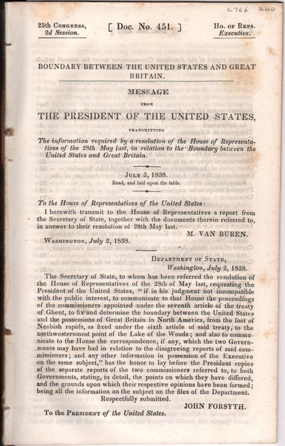
Subject: Central United States & Canada

Period: 1838 (published)

Publication: H.R. Doc. 451, 25th Congress, 2nd Session

Color: Black & White

Size:
5.6 x 8.9 inches
14.2 x 22.6 cm
Download High Resolution Image
(or just click on image to launch the Zoom viewer)

This report contains the proceedings of the Commissioners appointed under the seventh article of the Treaty of Ghent to fix and determine the boundary between the United States and Canada from the foot of the Neebish Rapids (intersection of Lake Superior and Huron) to the northwestern point of the Lake of the Woods. Included are the reports of both the American Commissioner and the British Commissioner. The 19 folding maps are mostly copies of 18th century maps covering the Lake Superior, Michigan and Huron areas by various map makers. Signed in type by M. Van Buren and John Forsyth. Disbound, 132 pages. The report is housed in archival paper covers with handwritten label.

References:

Condition: B+

Text and maps have some light scattered foxing. Disbound.

Estimate: $200 - $230

Sold for: $170

Closed on 2/8/2023

Archived