Catalog Archive
Auction 191, Lot 13

"Planisphaerium ex Polo Arctico tanquam centro Geometrice descriptu", Scherer, Heinrich
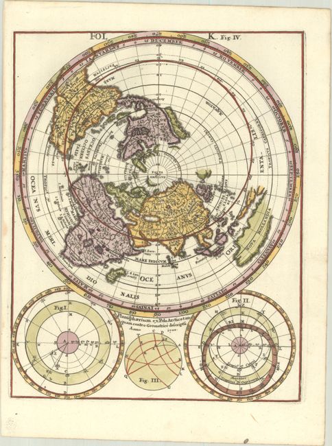
Subject: World

Period: 1700 (dated)

Publication: Novus Atlas

Color: Hand Color

Size:
7.4 x 9.3 inches
18.8 x 23.6 cm
Download High Resolution Image
(or just click on image to launch the Zoom viewer)

This interesting world map is depicted on a north polar projection and features California as an island. South America includes several conjectural lakes, and in Africa the source of the Nile River is shown as two large lakes south of the equator. New Guinea and Australia (Nova Hollandia) are only partially delineated. The Pacific Ocean is left largely blank, with partial outlines of two landmasses: one northwest of North America and the other just east of Japan. Below the map are three astronomical diagrams.

References: Shirley #634.

Condition: A

Minor stains in blank margins.

Estimate: $300 - $375

Sold for: $220

Closed on 2/8/2023

Archived