Catalog Archive
Auction 190, Lot 732

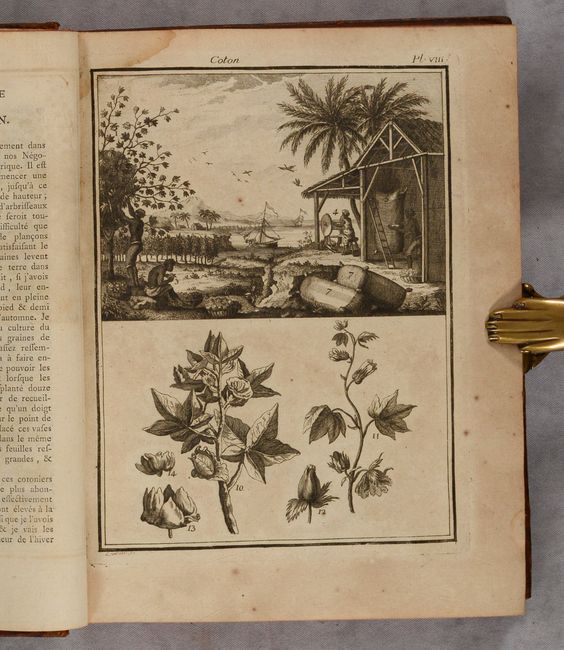
Colonial History of America with Description of Slave Trade

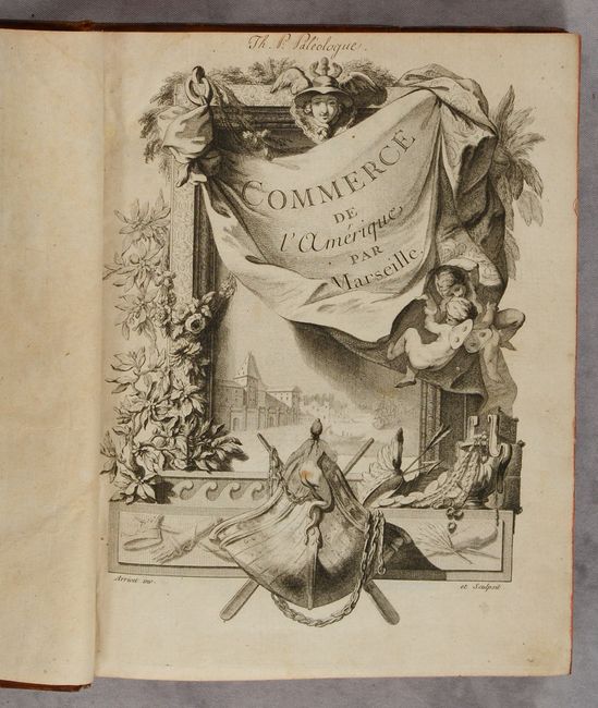
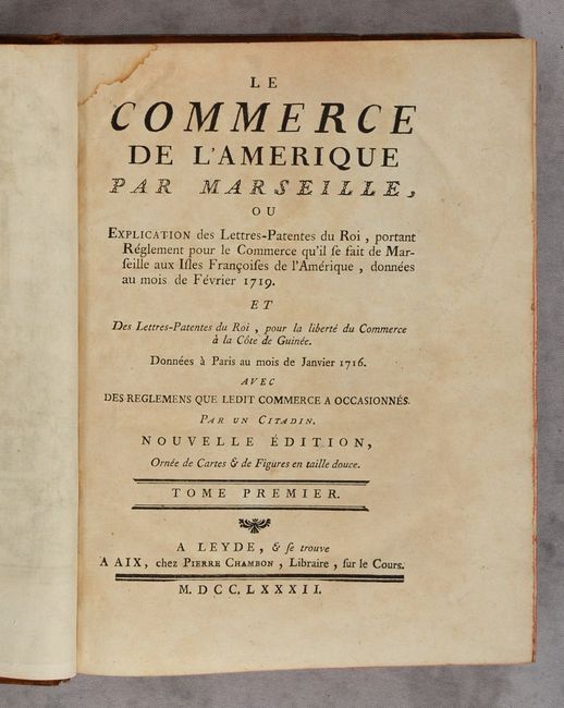
"[2 Volumes] Le Commerce de l'Amerique par Marseille, ou Explication des Lettres-Patentes du Roi...", Chambon

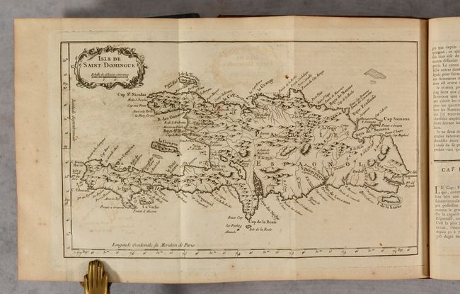
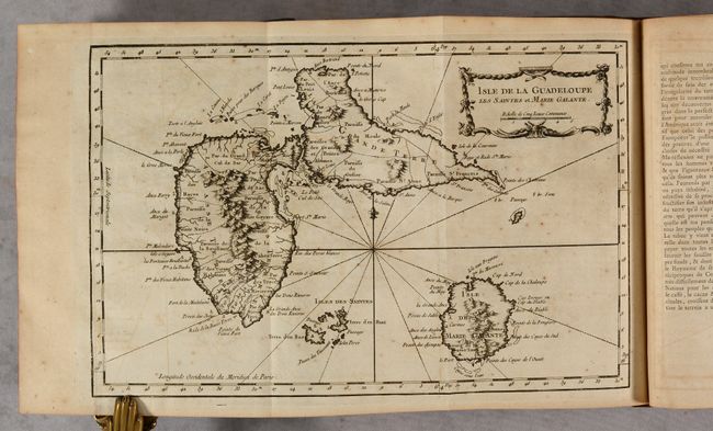
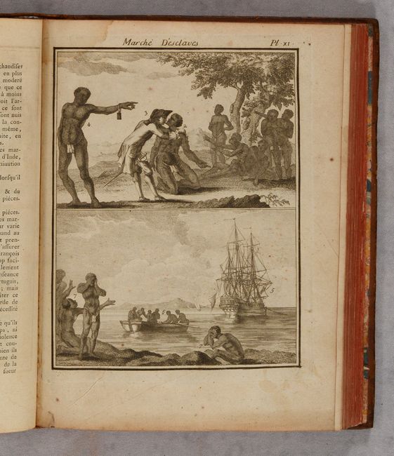
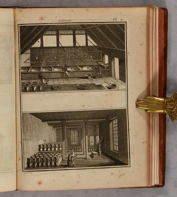
Subject: Exploration and Surveys, Colonial Americas

Period: 1782 (published)

Publication:

Color: Black & White

Size:
8 x 10.2 inches
20.3 x 25.9 cm
Download High Resolution Image
(or just click on image to launch the Zoom viewer)

This is one of the most important and complete works on the colonial history of America, focusing on the regulations and ordinances relating to trade between France and the Americas. Written by Pierre Chambon, this two-volume work describes the agricultural and industrial production of the French colonies and their trade. It includes information on the slave trade as well as the production of cotton, tobacco and sugar. It is illustrated by 8 maps copied from Jacques Nicolas Bellin and 12 engraved plates.

Both volumes contain the same map of North America, Amerique Septentrionale (11.6 x 8.7"), which extends to include the North Atlantic Ocean. The map is based on Bellin's 1755 map of North America with the western region mostly blank and a notation that the region is unknown. Various discoveries are noted, including Juan de Fuca (1592) and Martin d'Aguilar (1603), both of whom were purported to have discovered the Pacific entrance to a Northwest Passage. The Sea of the West (M. de l'Ouest) is named but not delineated. The British Colonies are confined to the eastern seaboard, with French Louisiana taking up the majority of the interior and Nouveau Mexique covering all the present-day western U.S. The remaining maps are:

A. Carte de la Louisiane et Pays Voisins (11.7 x 8.3").
B. Isle de la Martinique (13.5 x 8.4"). Engraved by Croisy.
C. Isle de Saint Domingue (13.3 x 8").
D. Isle de la Guadeloupe les Saintes et Marie Galante (13.5 x 8.7").
E. Amerique Meridionale (11.6 x 8.6").
F. Carte des Costes de Guinee (14.5 x 8.1").

Small quarto. Volume I: [6 pp.]; 615 pp.; frontispiece; title page; 5 maps; 7 plates. Volume II: [6 pp.]; 618 pp.; frontispiece; title page; 3 maps; 5 plates. Hardbound in full contemporary leather; raised bands, red leather title labels, and gilt tooling on spines; marbled endpapers.

References: cf. Sabin #11812.

Condition: B+

A nice example that has occasional foxing and toning. The maps and plates range in condition from very good (B+) to near fine (A). There is a light dampstain along the top gutter of volume II, entering the image just a bit on a couple of plates. The covers have light wear with a few scuffs and bumped corners. The spines have a little cracking and small abrasions.

Estimate: $1,400 - $1,700

Sold for: $1,000

Closed on 11/16/2022

Archived