Catalog Archive
Auction 190, Lot 35

"Carte des Phases de l'Eclipse du I. Avril 1764 et de Tous les Pays de la Terre ou l'on a pu Voir Cette Eclipse", Lalande, Joseph Jerome le Francaise de
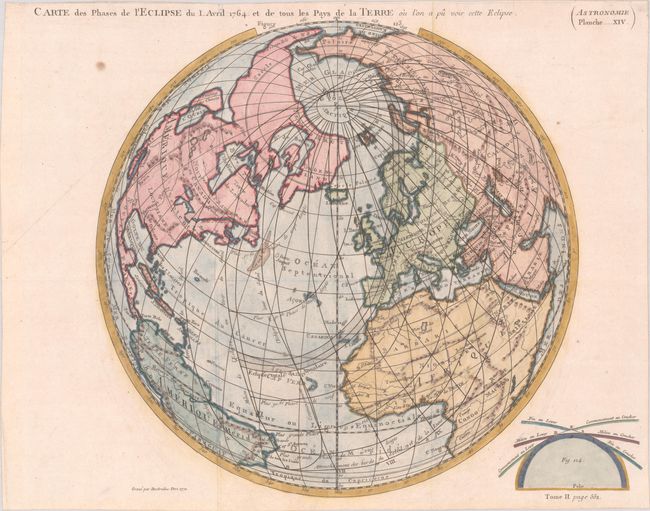
Subject: North Pole

Period: 1771 (dated)

Publication: Astronomie

Color: Hand Color

Size:
13.2 x 13.4 inches
33.5 x 34 cm
Download High Resolution Image
(or just click on image to launch the Zoom viewer)

This hemispherical map is depicted on a north polar slant, centered on the prime meridian. North America and Europe are shown in their entirety, but only part of South America, Africa and Asia fit within the projection. This map was created to show the path of the 1 April 1764 solar eclipse, which is illustrated through stippling. Geographical information is limited to major countries, rivers and mountains. In North America, only the cities of Jamestown, Boston and Quebec are named. In the Pacific Northwest, a large Sea of the West (M. de l'Ouest) is shown adjacent to an island named Fousang des Chinois. Fousang is derived from the book by Joseph de Guignes about China, wherein he mentions the Chinese colony of Fousang, based upon Hui Shen's supposed voyage in the 5th century AD. Engraved by Desbrulins and published in the 1771 edition of Astronomie by M. De la Lande.

References: McGuirk #144.

Condition: B+

Issued folding, now flattened on paper with a bunch of grapes watermark, a few small spots, and a hint of offsetting. Small remnants of hinge tape on verso.

Estimate: $350 - $425

Sold for: $475

Closed on 11/16/2022

Archived