Catalog Archive
Auction 190, Lot 331

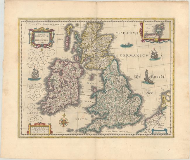
"Magnae Britanniae et Hiberniae Tabula", Blaeu, Willem

Subject: Britain

Period: 1645 (circa)

Publication:

Color: Hand Color

Size:
19.7 x 15.2 inches
50 x 38.6 cm
Download High Resolution Image
(or just click on image to launch the Zoom viewer)

This handsome map of the British Isles is believed to be printed from the revised plate of Hondius' carte-a-figures map of 1630. Blaeu acquired a number of Jodocus Hondius' plates from Hondius' widow in 1629. As this map was too large to fit in Blaeu's atlas, it is presumed that he removed the surrounding panels. It is filled with minutely engraved topographical and political detail of England, Wales, Ireland and Scotland, and is inset with a small map of the Orkney Islands. The map appeared in many of the Blaeu atlases between 1634 and 1672 and was included in all editions of the Blaeu atlas of England and Wales from 1645 onwards. It is decorated with a lovely compass rose, and a decorative scale of miles and title cartouche. Three delicately engraved ships and a large sea monster complete the composition. Blank verso.

References: Moreland & Bannister, p. 217; Shirley (BI to 1650) #423; Van der Krogt (Vol. II) #5000:2.2.

Condition: B+

A crisp impression on watermarked paper with a few faint spots and a soft extraneous crease across the middle of the map. The left and right sheet edges have been reinforced with old tape on verso.

Estimate: $700 - $850

Sold for: $500

Closed on 11/16/2022

Archived