Catalog Archive
Auction 190, Lot 272
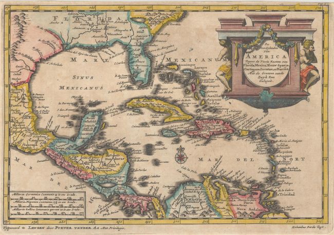
"De Voor Eylanden van America Tegens de Vaste Kusten van Florida, Mexico, Nieuw Spanje, Cartagena, Iucatanm en Darien met de Grenzen aande Zuyd Zee Gelegen", Aa, Pieter van der
1 of 2
Subject: Gulf of Mexico & Caribbean
Period: 1710 (circa)
Publication:
Color: Hand Color
Size:
8.8 x 6 inches
22.4 x 15.2 cm
Download High Resolution Image
(or just click on image to launch the Zoom viewer)
(or just click on image to launch the Zoom viewer)