Catalog Archive
Auction 190, Lot 131

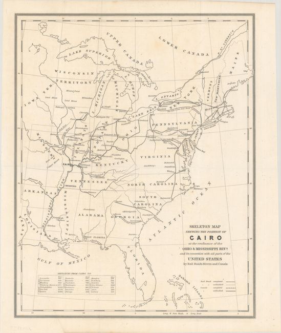
"Skeleton Map Shewing the Position of Cairo at the Confluence of the Ohio & Mississippi Rivs. and Its Connection with All Parts of the United States by Rail Roads Rivers and Canals", U.S. Government

Subject: Eastern United States, Illinois

Period: 1844 (circa)

Publication:

Color: Black & White

Size:
11.8 x 14.8 inches
30 x 37.6 cm
Download High Resolution Image
(or just click on image to launch the Zoom viewer)

This map accompanied an 1844 proposal to establish a shipyard in Cairo, Illinois. It focuses on the transportation options serving Cairo and the Midwest, but also shows the transportation network of the entire eastern U.S. and as far west as Iowa and Missouri. A legend at bottom right indicates completed and unfinished railroads and canals, and a table at lower left shows distances from Cairo to major cities. Memphis was ultimately chosen over Cairo for the new shipyard. OCLC shows only two institutional holdings.

References:

Condition: A

Issued folding with a few faint spots at top.

Estimate: $150 - $180

Sold for: $100

Closed on 11/16/2022

Archived