Catalog Archive
Auction 190, Lot 12

NO RESERVE

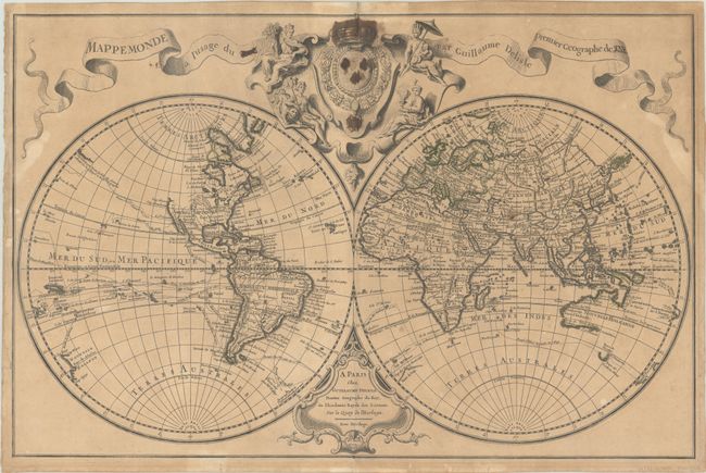
"Mappemonde a l'Usage du Roy", Delisle, Guillaume

Subject: World

Period: 1720 (dated)

Publication:

Color: Hand Color

Size:
26.4 x 17.3 inches
67.1 x 43.9 cm
Download High Resolution Image
(or just click on image to launch the Zoom viewer)

This double-hemisphere map of the world shows the routes of numerous explorers, including Magellan (1520), Mendanna (1595), Quiras (1605), Le Maire (1615), Tasman (1642), St. Louis (1708), and Antoine (1710). The Pacific Northwest coast of North America is left blank above Cap Blanc, and Australia and New Zealand are only partially mapped. Mainland Asia is severely truncated to the northeast with no sign of Kamchatka. Both D'Yeco and Japan appear connected to the mainland, with the sea between Korea and Japan called Mer Orientale. To the northeast of Japan is Terre de la Compagnie which extends into the western hemisphere with a note that explains the land was sighted by Dom Jean de Gama. Above the map is a decorative cartouche featuring the French coat of arms surrounded by allegorical figures representing the four continents.

References:

Condition: B

A dark impression on a moderately toned sheet with contemporary outline color, light foxing, and a few short edge tears that have been archivally repaired. This example must have been previously owned by an enemy of the king, as the word "king" (Roy) as well as the crown and other symbols of the king, have been defaced with old manuscript ink, causing a few short tears that have been archivally repaired on verso.

Estimate: $800 - $950

Sold for: $350

Closed on 11/16/2022

Archived