Catalog Archive
Auction 189, Lot 87

"Amerique Septentrionale Divisee en ses Principales Parties", Elwe, Jan Barend

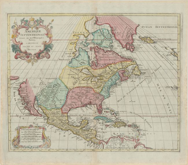
Subject: North America

Period: 1792 (dated)

Publication:

Color: Hand Color

Size:
22.8 x 18.4 inches
57.9 x 46.7 cm
Download High Resolution Image
(or just click on image to launch the Zoom viewer)

Large, decorative map copied from the Jaillot/Sanson map of 1694 with the same decorative title and scale of miles cartouches. The plate was acquired at the dissolution of the Jaillot firm in 1781, and revised with Elwe's imprint. The map has been somewhat updated with the western Great Lakes complete, and a peninsular California. Buttons Bay is open-ended, allowing the possibility of an inland passage to the Pacific. The R. del Norte originates from a large lake and empties into the Mer Rouge (Gulf of California). To the west, California is separated from Terre de Iesso ou Ieco by the Mer de Iesso. The political divisions are outdated with the continent still divided between the colonial interests of England, France and Spain.

References: Burden #700.

Condition: A

Contemporary color in the map with later color in the cartouches on a bright sheet with a "Henry Reno" watermark. The impression is a bit uneven at bottom, and there is light printer's ink residue, a tiny hole near the mouth of the Mississippi River, minor toning along the centerfold, and light foxing mostly confined to the blank margins.

Estimate: $950 - $1,200

Sold for: $700

Closed on 9/14/2022

Archived