Catalog Archive
Auction 189, Lot 356

"Scandia sive Regiones Septentrionales", Lasor a Varea, Alphonsus

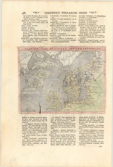
Subject: Arctic, Britain, & Scandanavia

Period: 1713 (published)

Publication: Universus Terrarum Orbis

Color: Hand Color

Size:
6.8 x 5 inches
17.3 x 12.7 cm
Download High Resolution Image
(or just click on image to launch the Zoom viewer)

This small and fascinating map is based on Ortelius' Septentrionalum of 1570, which in turn was based on the mapping of Nicholas Zeno in 1558. The map shows two Greenlands, one just above the other, as well as the imaginary islands of Frisland and St. Brendain, along with many other small, phantom islands in the North Sea. The North Pole carries a note of Pigmei hic habitant, indicating that pygmies live there. The island of Drogeo shown off the coast of Estotilant is thought to represent Newfoundland. The engraving was taken from a plate originally published in Magini's Geographiae Universae (1596); there is evidence of a crack in the plate, revealing its age. Lasor a Varea, whose real name was Raffaello Savonarola, published his two-volume scriptural and historical dictionary with nearly 500 maps that were taken from old plates by Valegio, Porcacchi, Rosaccio-Franco, and Magini, many of which were more than a century old, and often reworked. On a sheet of Latin text measuring 9.1 x 13.5".

References: Phillips (Atlases) #3475 Vol. II-482; Shirley (BL Atlases) T.LAS-1a #406.

Condition: A

There is minor printer's ink residue.

Estimate: $200 - $230

Sold for: $150

Closed on 9/14/2022

Archived