Catalog Archive
Auction 189, Lot 353

A Cartographic Milestone - Scientific Mapping of Iceland

"Insulae Islandiae Delineatio, Prout haec Solenni Mensurandi Negotio sub Auspicus Pontentissimi Regis Daniae Facto...", Homann Heirs
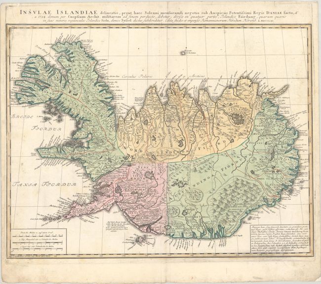
Subject: Iceland

Period: 1761 (dated)

Publication:

Color: Hand Color

Size:
23.3 x 17.8 inches
59.2 x 45.2 cm
Download High Resolution Image
(or just click on image to launch the Zoom viewer)

This folio-sized map of Iceland is based upon the work of Thomas Hans Henrik Knoff, a Norwegian surveyor who worked under the authority of the Danish government. Knoff was sent to Iceland to complete the work of Magnus Arason who had passed away mid-project. He spent the following five summers completing the necessary field work and produced his large map of Iceland in 1734. Knoff's map represented a milestone in the history of cartography for Iceland as it was the first map to use scientific techniques for mapping the entire island.

In 1750, Otto Manderup Rantzau became the administrator for Iceland and after learning of this map (which had been under lock and key by the Danish government), employed the Homann firm to engrave a reduced version. While the Knoff/Homann Heirs map still includes many inaccuracies in both geography and place names, it does reflect a level of detail not previously seen including more precise locations for volcanoes, mountains, fjords, rivers, and lakes. Numerous roads are also depicted, connecting the various towns and villages along the well-developed coastline. The map is augmented by three distance scales at lower left, explanatory text at lower right, and a Latin title above the map. There appears to be only one edition of this map, and is therefore uncommon on the market. A desirable map for any Iceland collection.

References:

Condition: B+

A nice impression on a bright, watermarked sheet with light soiling, minor creasing along the centerfold, and remnants of hinge tape on verso.

Estimate: $475 - $600

Sold for: $450

Closed on 9/14/2022

Archived