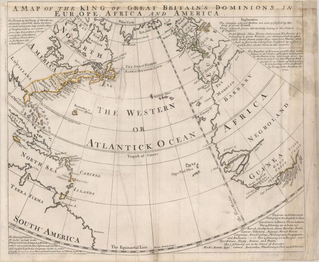
This scarce map drawn on a circular projection shows the extent of Great Britain's empire in the middle of the 18th century. It centers on the Western or Atlantick Ocean and stretches from the Arctic Circle down to the equator. A note beneath the title at top right explains the color coding of the map, with all areas outlined in yellow part of the contemporary British empire, and those in green formerly belonging to England. Additionally, places distinguished by a fine black stroke drawn under their respective Names are under the crown's rule as of the time of publication, while a dashed stroke indicates a former possession. On the Western Hemisphere, nine colonies are delineated and outlined in yellow, with St. Augustine, Charleston, Boston, and many capes and bays identified along the coast. The area west of the Appalachians is labeled as Louisiana. Florida appears in an unusual shape. Several islands in the West Indies are also yellow. Curiously, the area of Canada called New Britain is left uncolored. A rather sizable note off the coast of Newfoundland announces The Great Fishing Bank of New-Found Land, with text at top left outside the map discussing the places the French can legally fish in the area after the Treaty of Utrecht.
On the Eastern Hemisphere, Portugal and the coast of France are outlined in green. Much of Africa is left unengraved except for around Grain Coast, Gold Coast, and Slave Coast, where several places are named and specified as British possessions.
References:
Condition: B
Issued folding, now pressed flat, with extraneous creasing and some staining and toning along the right edge of the map. The sheet has been remargined at top with a portion of the title replaced in facsimile.