Catalog Archive
Auction 189, Lot 291

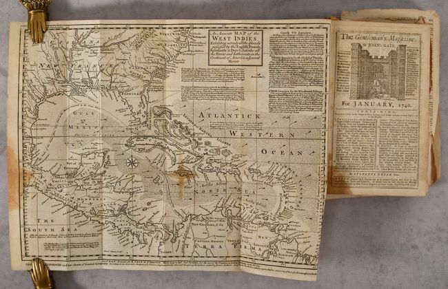
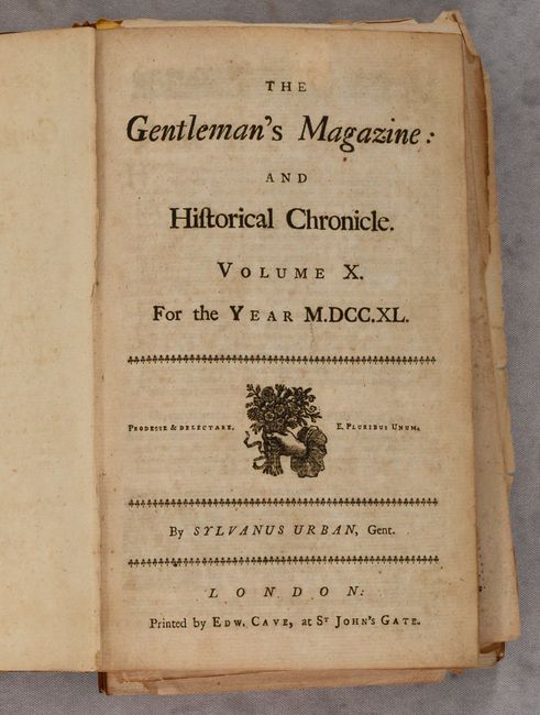
"[Map in Book] An Accurate Map of the West Indies. Exhibiting Not Only All the Islands Possess'd by the English, French, Spaniards & Dutch... [in] The Gentleman's Magazine: and Historical Chronicle. Volume X. For the Year M.DCC.XL", Bowen, Emanuel

Subject: Gulf of Mexico & Caribbean

Period: 1740 (published)

Publication:

Color: Black & White

Size:
15.2 x 11.6 inches
38.6 x 29.5 cm
Download High Resolution Image
(or just click on image to launch the Zoom viewer)

This handsome and fully engraved map covering the Southern U.S., Central America, the West Indies, and northern South America was published in the January 1740 issue of the Gentleman's Magazine. It presents a fascinating configuration of Florida as wedge-shaped with a flat bottom. The chart is covered with interesting notations concerning the history of the region, territorial claims, and the Spanish gold fleet. The seas are fully engraved with ruled lines and an extensive array of trade-wind arrows. Compass rose and block-style title cartouche. A long notation gives sailing directions from Europe, Africa, Florida to Jamaica, and from Jamaica to the Windward Passage. The map is bound into a book collecting the ten volumes of Gentleman's Magazine published in 1740. 660 pp., plus index. Hardbound in quarter leather over marbled boards.

References: Jolly #GENT-6; Sellers & Van Ee #1681.

Condition: B

The map is issued folding with dampstains that enter map image at left and center, minor offsetting, an archivally repaired fold separation at left, and a short binding tear at right. The spine is perished and front cover detached, and the contents have been broken into 4 sections with several pages completely disbound. Condition grade is for the map.

Estimate: $200 - $230

Sold for: $150

Closed on 9/14/2022

Archived