Catalog Archive
Auction 189, Lot 1

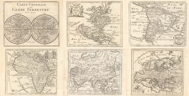
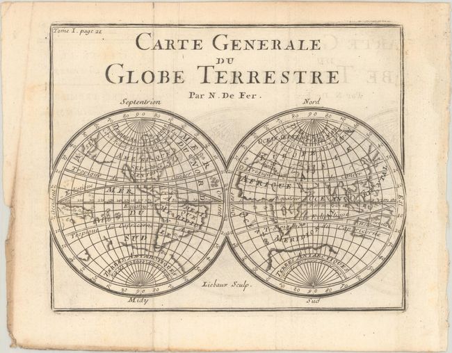
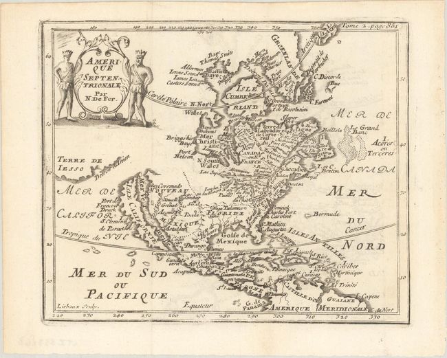
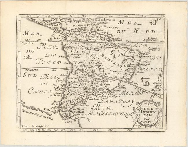
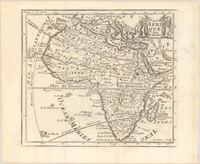
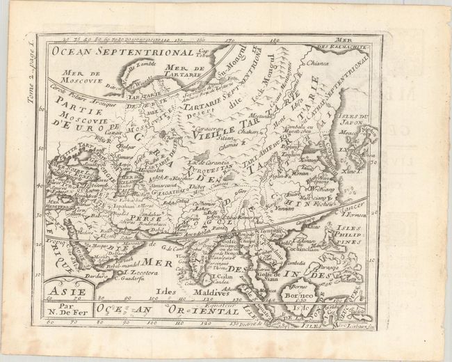
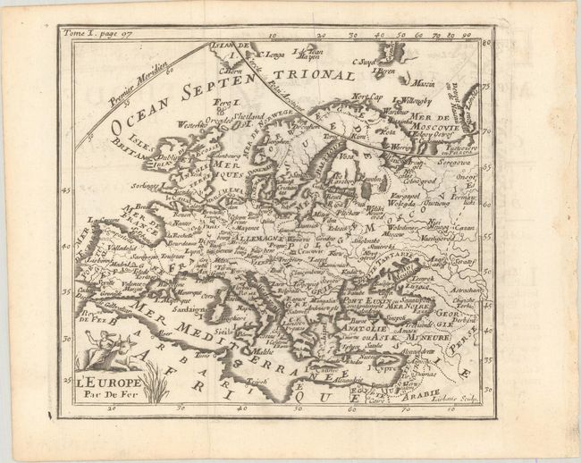
"[Lot of 6] Carte Generale du Globe Terrestre [and] Amerique Septentrionale [and] Amerique Meridionale [and] Afrique [and] Asie [and] L'Europe", Fer, Nicolas de

Subject: World & Continents

Period: 1746 (circa)

Publication: Methode pour Apprendre Facilement la Geographie

Color: Black & White

Size:
6.6 x 5.3 inches
16.8 x 13.5 cm
Download High Resolution Image
(or just click on image to launch the Zoom viewer)

A lovely matching set of world and continents from this miniature atlas, engraved by Jean Baptiste Liebaux. Size varies slightly.

A. Carte Generale du Globe Terrestre. This double hemisphere map of the world shows the island of California and a long coastline extending between Asia and North America. The large southern continent, Terre Antarctiques, still appears, and Australia and New Zealand are only partially formed. There is minimal detail within each continent, with only major rivers and lakes depicted.

B. Amerique Septentrionale. This attractive small map includes numerous interesting features. California is shown as an island while the northwest coast of North America remains blank. To the west is a partial outline of Terre de Iesso separated from the continent by the Detroit d'Anien. The Great Lakes appear to all be joined, and remain open-ended to the west. The St. Lawrence River flows much too far to the south and Hudson Bay is labeled Mer Christiane. The entire south is labeled as Floride and the west is Nouveau Mexique. This is the fourth state with the engraved page number 351 at top right.

C. Amerique Meridionale. The Amazon, Orinoco, and Parana Rivers are quite exaggerated on this map. While the mythical Lake Parime does not appear in the North, the fabled Maonoa el Dorado is noted, and a large Lac Moncontos (more commonly known as Xarayes) appears in the center of the continent. The large southern continent, here named Terres Inconnues, is also depicted.

D. Afrique. This handsome small map of Africa is filled with spurious cartography, including a depiction of the Nile River (Nils des Anciens) originating from the two Ptolemaic source lakes south of the equator. The source of the Blue Nile is correctly located at Lake Tana in East Africa and the Niger River is shown with its traditional source at Lac Niger just north of the equator. Two St. Helena islands still appear in the Atlantic Ocean. The map was prepared by De Fer and modeled after Pierre Duval's four-sheet map published in 1678. The drape-style title cartouche is flanked by a pair of lions.

E. Asie. Geographic misconceptions continue on this map, with a very elongated Korean peninsula and the mythical (but here unnamed) Chimay Lacus, with four rivers flowing south. Japan has an odd shape, and the Kamchatka Peninsula extends indefinitely to the east.

F. L'Europe. A charming small map of the continent, extending north to show Iceland and Jan Mayen Island. Only major rivers, cities, and political boundaries are depicted. The title cartouche features Europa and the bull.

References: Betz #135.4; Burden #604.

Condition:

Issued folding on mostly clean bright sheets with some light offsetting. World/Asia (B+), All Others (A). The first image is a composite image - the maps are on 6 separate sheets.

Estimate: $700 - $850

Sold for: $450

Closed on 9/14/2022

Archived