Catalog Archive
Auction 189, Lot 106

"Carte Particuliere de l'Amerique Septentrionale, ou sont Compris le Destroit de Davids, le Destroit de Hudson, &c. Dresse sur les Relations les Plus Nouvelles", Mortier, Pierre

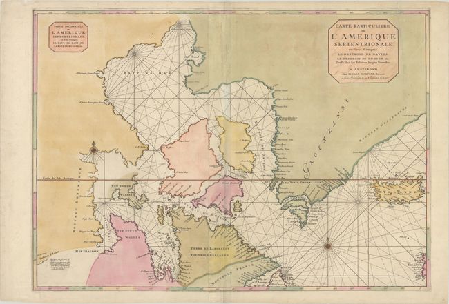
Subject: Northern Canada, Greenland & Iceland

Period: 1700 (circa)

Publication:

Color: Hand Color

Size:
32.4 x 22.9 inches
82.3 x 58.2 cm
Download High Resolution Image
(or just click on image to launch the Zoom viewer)

A beautifully engraved, large sea chart of the Arctic regions covering from Hudson and Baffins bays to Iceland and a bit of the coast of Ireland. Interestingly, the Destroit d' Anian is located quite close to the open-ended Buttons Bay in the bottom left corner of the map. Kershaw notes that the chart is based on Sanson's cartography, and though it offers nothing new, it "results in an impressive map of the Arctic as it was known at the close of the 17th century." This is the first state according to Burden.

References: Burden #763; Kershaw #177.

Condition: B

Full contemporary color with numerous small cracks from the oxidation of the green pigment that have been mostly closed on verso with archival materials. A 9" edge tear at top right has been repaired with archival materials on both recto and verso. Several centerfold separations at top and bottom have also been archivally repaired with minute loss along the upper centerfold.

Estimate: $500 - $650

Sold for: $275

Closed on 9/14/2022

Archived