Catalog Archive
Auction 188, Lot 87

"Theatre de la Guerre en Amerique, avec les Isles Antilles; Projette et Assujettie aux Observations", Bonne/Lattre

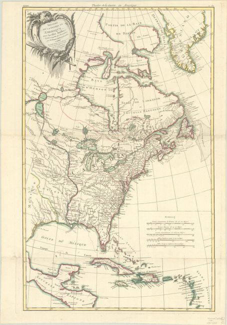
Subject: Colonial Eastern North America & West Indies

Period: 1781 (dated)

Publication: Atlas Moderne...

Color: Hand Color

Size:
17.2 x 27.1 inches
43.7 x 68.8 cm
Download High Resolution Image
(or just click on image to launch the Zoom viewer)

This crisply engraved Revolutionary War period map shows the region embroiled in the conflict and extends from eastern Canada and Greenland to Tobago in the West Indies. In Canada, it includes an interesting depiction of a passage between Lake Winnipeg and Hudson Bay alluding to a possible Northwest Passage to the Pacific. French Louisiane is sandwiched between Mexique and the British Colonies with their western boundary on the Mississippi River. There is nice detail, particularly of the French forts and Indian villages. This map began life in 1771 with the title "Partie de l'Amerique Septentrionale, qui comprend le Canada, la Louisiane, le Labrador, le Groenland, la Nouvelle Angleterre, la Floride &c." It went through several editions to 1783, with title changes to reflect the changing political climate. Printed on two joined sheets, as issued.

References: cf. McCorkle #771.2 & 779.2; cf. Sellers & Van Ee #165.

Condition: A

Contemporary outline color on a clean sheet with watermark of a Maltese Cross encircled by rosary beads. Issued folding.

Estimate: $1,200 - $1,500

Sold for: $900

Closed on 6/22/2022

Archived