Catalog Archive
Auction 188, Lot 534

Rare Early Map of Albania

"Albania Propria Overo Superiore detta Anche Macedonia Occidentale Descritta, con Disegni Fatti sul Luogo...", Cantelli da Vignola/de Rossi
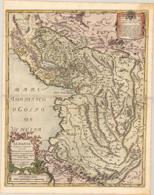
Subject: Albania

Period: 1689 (dated)

Publication: Mercurio Geografico...

Color: Hand Color

Size:
16.9 x 21.3 inches
42.9 x 54.1 cm
Download High Resolution Image
(or just click on image to launch the Zoom viewer)

This rare and beautifully engraved map is the first accurate printed map to focus on Albania (while charming, Giovanni Francesco Camocio's late 16th-century map Provincia di Albania lacks cartographic rigor.) Centered on the Gulf of Drin, the map shows most of present-day Albania, extending south of the Golfo della Valona (Bay of Vlore). Portions of Montenegro, Kosovo, and Northern Macedonia are depicted as well. Numerous towns and cities are named, most notably Tirana, Durres, Skopje, and Prizren. Petrela is noted as birthplace of Alexander the Great. The mountainous topography of the region is boldly rendered. There is a dedicatory cartouche at top right that pays tribute to Giovanni Francesco Albani, who would become Pope Clement XI less than a decade after the map's publication. A distance scale appears below the ornate title cartouche at bottom left.

References: Shirley (BL Atlases) T.ROSS-1d #122.

Condition: B+

A nice impression on watermarked paper with light scattered foxing, light toning along the centerfold, and a short edge tear at top left.

Estimate: $400 - $475

Sold for: $300

Closed on 6/22/2022

Archived