Catalog Archive
Auction 188, Lot 396

"La Plus Grande Partie de la Manche, qui Contient les Cotes d'Angleterre et Celles de France les Bords Maritimes de Picardie...", Lotter, Tobias Conrad

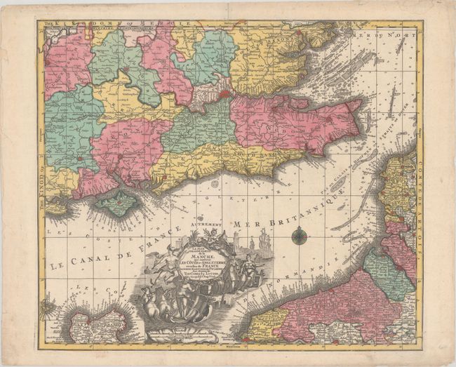
Subject: English Channel

Period: 1760 (circa)

Publication:

Color: Hand Color

Size:
22.6 x 19.4 inches
57.4 x 49.3 cm
Download High Resolution Image
(or just click on image to launch the Zoom viewer)

This handsome German map of the eastern part of the English Channel spans from Gloucestershire across the Channel to coastal Normandy, and shows the Isle of Wight. It features plenty of navigational information, including depth soundings, anchorages, and sand banks. There is good inland detail of political divisions, place names, roads, rivers, and topography. The spectacular title cartouche depicts a seaside scene with Mercury, Neptune, a castle, sailing ships, and more. Two distance scales appear in a shell-style cartouche, and there is a compass rose capped with a fleur-de-lis in the Channel. This map is virtually identical to Seutter's map of the same name.

References:

Condition: B+

Full contemporary color with light soiling, a horizontal printer's crease at right, and short centerfold separations at top and bottom that have been archivally repaired. There is light dampstaining in the top blank margin, and a chip and a few edge tears in the left blank margin have also been archivally repaired.

Estimate: $200 - $230

Sold for: $150

Closed on 6/22/2022

Archived