Catalog Archive
Auction 187, Lot 371

"Tabula Islandiae Auctore Georgio Carolo Flandro", Hondius/Blaeu
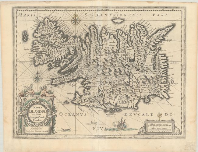
Subject: Iceland

Period: 1630 (circa)

Publication:

Color: Hand Color

Size:
19.6 x 15 inches
49.8 x 38.1 cm
Download High Resolution Image
(or just click on image to launch the Zoom viewer)

This handsome copper engraved map of Iceland was based on information from a Dutch navigator named Joris Carolus in about 1620. The map shows the influence of both versions of Bishop Gudbrandur's previous maps, a coastline resembling the Ortelius version, and Mercator's selection and spelling of many place names. The island's topography is dominated by huge mountains and volcanoes and its shoreline is a rugged labyrinth of fiords. It is richly embellished with title and distance scale cartouches, compass roses, rhumb lines, a sailing ship and two sea monsters. The cartouche features two winged sprites, an important symbol in Icelandic and Norse mythology. Along with elves and dwarves, sprites were magical beings who aided the gods. The map was first issued by Jodocus Hondius and then re-issued by Willem Blaeu with his imprint. It became the prototype for the mapping of Iceland and its influence did not wane until the mid-18th century. Blank verso.

References: IMCOS (Exploring Old Landscapes) pp. 8-9; Van der Krogt (Vol. II) #1250:2.2.

Condition: B+

A nice impression with only a bit of color in the decorative elements on a bright sheet with a Strasbourg bend watermark with the initials "I B." There is light soiling and professional repairs to a centerfold separation at bottom and some small chips and tears along the edges of the sheet.

Estimate: $600 - $750

Sold for: $375

Closed on 4/27/2022

Archived