Catalog Archive
Auction 187, Lot 368

"A New Generall Chart for the West Indies of E. Wrights Projection vut. Mercators Chart", Seller and Price

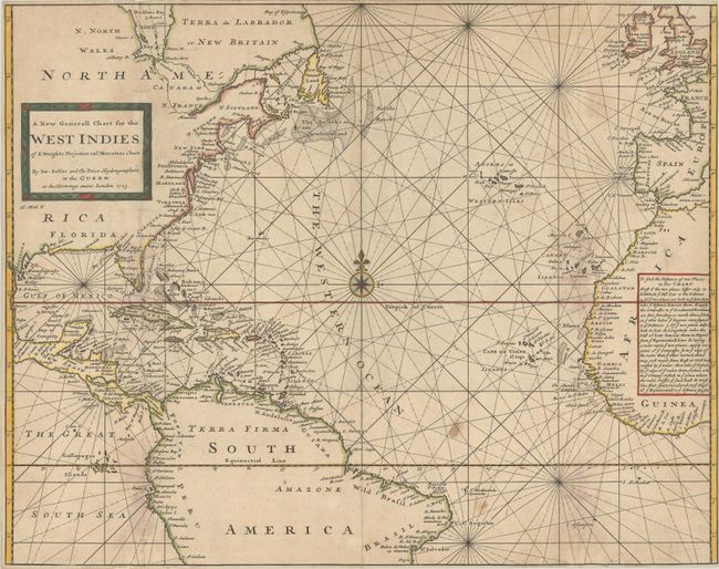
Subject: North Atlantic

Period: 1703 (dated)

Publication:

Color: Hand Color

Size:
22.5 x 17.8 inches
57.2 x 45.2 cm
Download High Resolution Image
(or just click on image to launch the Zoom viewer)

This crisply engraved sea chart covers most of the Atlantic Ocean but, as noted in the title, focuses on the West Indies. The map shows the eastern coastal area of North and Central America, as well as northern South America, and it extends to show the western coast of Africa and part of Europe. Place names appear along the coasts, but the interior areas are left blank. The chart is centered on a large compass rose, and the title is enclosed in a picture frame-style cartouche. A text panel in the interior of Africa explains the use of the chart. Its projection is based on the groundbreaking work of Edward Wright (1561-1615), the English mathematician and cartographer who explicated the mathematical principles behind Mercator's projection, thereby making possible its widespread use by mapmakers and navigators. The chart was engraved by Herman Moll, as noted below the cartouche.

References:

Condition: B

A sharp impression issued folding, now flat and backed with archival tissue, with numerous small tears along the vertical folds that have been professionally repaired on verso. There is some light dampstaining, minor soiling, and the right side has been trimmed close to the border.

Estimate: $550 - $700

Sold for: $325

Closed on 4/27/2022

Archived