Catalog Archive
Auction 187, Lot 343

NO RESERVE

"[Lot of 2] Carte du Bresil, Prem. Partie. Depuis la Riviere des Amazones Jusqu'a la Baye de Tous les Saints... [and] Carte de la Partie Meridional du Bresil avec les Possessions Espagnoles Voisines qui en sont a l'Ouest",
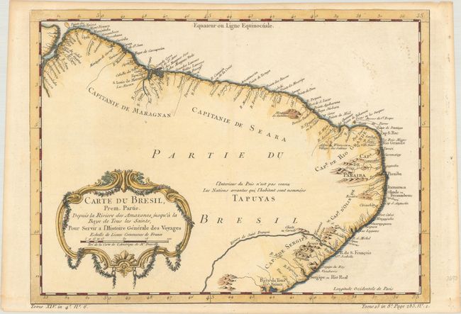
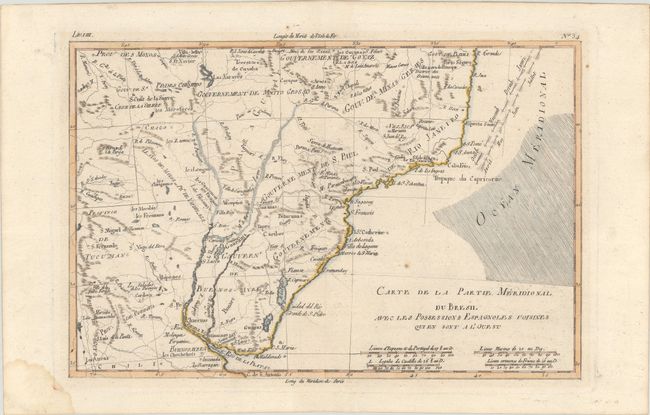
Subject: Brazil

Period: 1760-80 (circa)

Publication:

Color: Hand Color

Size:
See Description
Download High Resolution Image
(or just click on image to launch the Zoom viewer)

A. Carte du Bresil, Prem. Partie. Depuis la Riviere des Amazones Jusqu'a la Baye de Tous les Saints, pour Servir a l'Histoire Generale des Voyages, by Jacques Nicolas Bellin, from Histoire Generale des Voyages, circa 1760 (12.6 x 9.3"). This copper engraved map covers from the mouth of the Amazon to Salvador. Only coastal detail is shown with regions divided into the Capitaineries or hereditary harbor offices. Decorated with a garland-draped title cartouche. The Tapuyas Indians occupy the hinterlands. Condition: Fine impression on hand laid paper with a "D&B" watermark. There are two light areas of foxing in blank ocean at upper right and light toning along the edges of the sheet. (A)

B. Carte de la Partie Meridional du Bresil avec les Possessions Espagnoles Voisines qui en sont a l'Ouest, by Rigobert Bonne, circa 1780 (12.3 x 8.2"). This map depicts southern Brazil and present-day Uruguay from Porto Seguro in the north to the Rio de la Plata in the south. Towns, mountains, rivers, and lakes are shown, including the fictitious Lac Xarayes. The directions of the trade winds are shown in the Atlantic. Condition: There is one spot of foxing in a blank area of the ocean at right, a damp stain in the blank margin at bottom left, and paper tape along the top edge of the sheet on verso. (B+)

References:

Condition:

See description above.

Estimate: $120 - $150

Sold for: $60

Closed on 4/27/2022

Archived