Catalog Archive
Auction 187, Lot 240
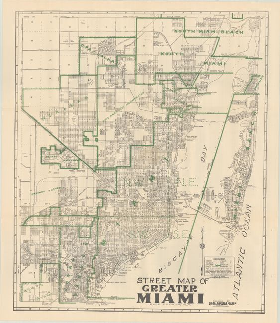
"Street Map of Greater Miami Dade County, Fla. ",
1 of 2
Subject: Miami, Florida
Period: 1942 (circa)
Publication:
Color: Printed Color
Size:
20.1 x 23.9 inches
51.1 x 60.7 cm
Download High Resolution Image
(or just click on image to launch the Zoom viewer)
(or just click on image to launch the Zoom viewer)