Catalog Archive
Auction 187, Lot 23

"An Accurate Chart of the World, with the New Discoveries; Also a View of the General & Coasting Trade Winds, Monsoons or Shifting Trade Winds...", Kitchin, Thomas
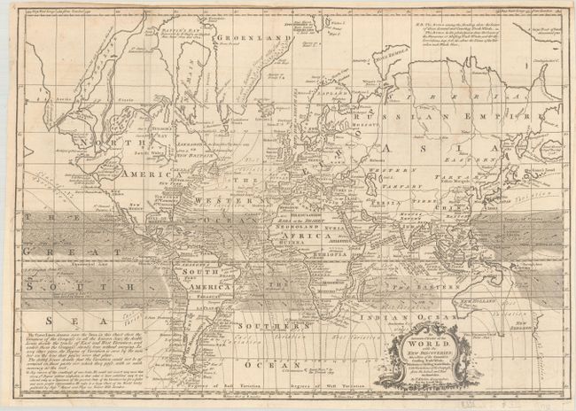
Subject: World

Period: 1758 (published)

Publication: London Magazine

Color: Black & White

Size:
17.5 x 12.4 inches
44.5 x 31.5 cm
Download High Resolution Image
(or just click on image to launch the Zoom viewer)

This detailed chart of the world was published in the February 1758 edition of London Magazine. Presented on Mercator's Projection, the map depicts the trade winds, magnetic variation, and recent discoveries around the world. Of particular interest is the depiction of the western coast of North America that presents a large West Sea. This is an early delineation of the Sea of the West based upon Delisle. To its north is a confusing series of landmasses based upon Russian discoveries in 1728 and 1741, divided by Bernarda River and Lake. In the South Pacific, New Zealand and Australia are shown with only partial coastlines, and Australia is still attached to New Guinea. A fascinating and detailed chart reflecting the latest knowledge.

References: Jolly #LOND-132; McGuirk #69.

Condition: B+

A nice impression issued folding, now pressed, with light offsetting, a few tiny tears, and a crease at bottom left. The margin at top has been trimmed and then extended with old paper, with a small portion of neatline replaced in facsimile. A binding trim in the bottom left margin has also been replaced with old paper.

Estimate: $475 - $600

Sold for: $400

Closed on 4/27/2022

Archived