Catalog Archive
Auction 187, Lot 1

Matching Set of Miniature Ortelius Maps

"[Lot of 5] Typus Orbis Terrarum [and] Americae sive Novi Orbis Nova Descriptio [and] Africae Tabula Nova [and] Asiae Nova Descr: [and] Europa", Ortelius/Galle

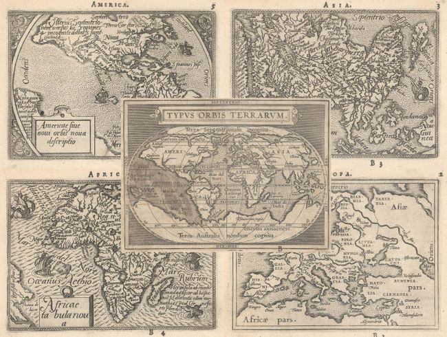
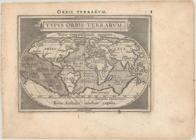
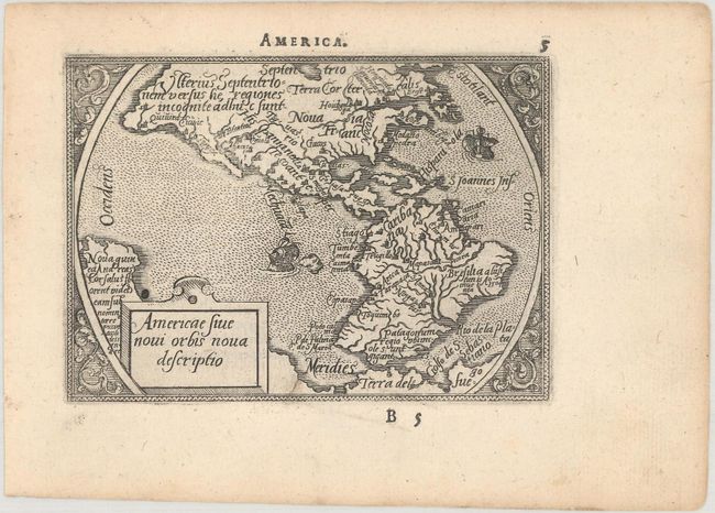
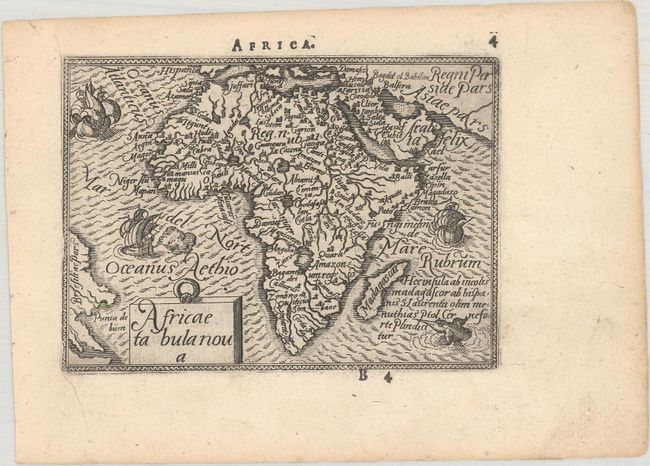
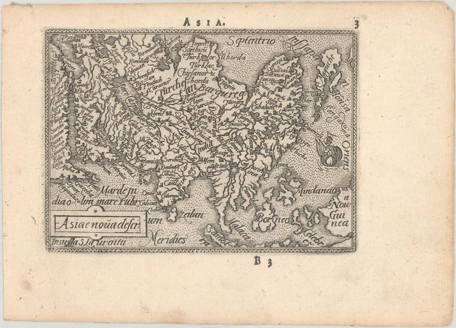
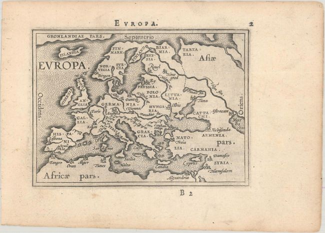
Subject: World & Continents

Period: 1589 (published)

Publication: Epitome Theatri Orteliani

Color: Black & White

Size:
4.3 x 3.1 inches
10.9 x 7.9 cm
Download High Resolution Image
(or just click on image to launch the Zoom viewer)

This matching set of miniature world and continents maps are reduced-size versions of Ortelius' folio maps. The first pocket version of Ortelius' Theatrum was published by Philippe Galle in 1577 as Spieghel der Werelt. Galle began a new edition with new plates, commonly known as the Epitome, in 1588. Galle's miniature atlas was quite popular, and was published in editions until 1602. From 1583 he gradually introduced a new set of maps, both adding to and replacing the originals. In this set the maps of America, Africa and Asia are from the original plate with small decorative borders, while the world and Europe maps are from the updated second series of plates with plain double-line borders. Latin text on verso.

A. Typus Orbis Terrarum. This map was reduced from Ortelius' folio map of 1587. While North America is still a bit too broad, South America has a more correct form. The Northwest Passage, taken from Mercator, is still prominent and there are large landmasses at both poles. References: Shirley #161; Van der Krogt (Vol. III) #0001:332A.

B. Americae sive Novi Orbis Nova Descriptio. This is a reduced version of Ortelius' 1570 folio map of the Americas. The characteristic bulges in the western coastlines of both continents and the huge southern continent are instantly recognizable. Ornamented with two sailing ships and a delicate floral surround. References: Burden #48; Van der Krogt (Vol. III) #9000:331.

C. Africae Tabula Nova. The map is decorated with three sailing ships, a sea monster, and fully engraved seas. The most notable change made from the folio map to its miniature version is the removal of Lake Zaflan, the smaller of the two Ptolemaic source lakes for the Nile River. References: Betz #18; Van der Krogt (Vol. III) #8600:331.

D. Asiae Nova Descr:. This fine miniature map is based on Ortelius' great map of Asia that was the standard map of Asia for more than forty years. Japan is in a 'kite' form taken from Jesuit sources and the islands of the East Indies are not well placed, due to the secrecy of voyages to the region. The Caspian Sea is in a simple oval shape and oriented the wrong direction. References: Van der Krogt (Vol. III) #8000:331.

E. Europa. This simple map of Europe focuses on the major rivers, mountain ranges, and cities in Europe. Greenland stretches across the top of the map. References: Van der Krogt (Vol. III) #1000:332.

References: King (2nd Ed.) pp. 64-65 & 88-89.

Condition: A

Crisp impressions with minor soiling mostly in the margins that is slightly more prominent on the world map.

Estimate: $1,400 - $1,700

Sold for: $1,000

Closed on 4/27/2022

Archived