Catalog Archive
Auction 187, Lot 184

"A New Map of the Province of Maryland in North America", Anon.

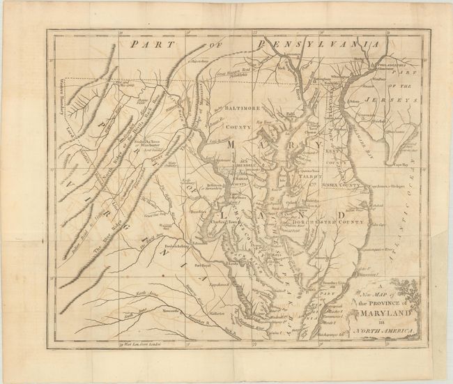
Subject: Colonial Mid-Atlantic United States

Period: 1780 (published)

Publication: Universal Magazine

Color: Black & White

Size:
13 x 10.9 inches
33 x 27.7 cm
Download High Resolution Image
(or just click on image to launch the Zoom viewer)

This copper engraved map was issued during the Revolutionary War. It covers the region of Chesapeake Bay with great detail of settlements and roads, including the "Indian Road to Virginia" and the "Great Waggon Road to Philadelphia." Locates Fredericksburg, Charles Town, Oxford, Philadelphia, and Annapolis. Delaware is labeled "Newcastle C. Part of the Jerseys". The Western Boundary and Lord Fairfax's Boundary Lines are shown. The Boundary Line of 1688 is noted between Maryland and Virginia adjacent to Watkin's Point. Decorative title cartouche.

References: Jolly #UNIV-184; Sellers and van Ee #1412; Phillips (M) p. 394

Condition: B+

Issued folding on watermarked paper with light offsetting. There is a binding trim at lower right and an associated 2" binding tear that has been repaired on verso with archival materials.

Estimate: $375 - $450

Sold for: $375

Closed on 4/27/2022

Archived