Catalog Archive
Auction 187, Lot 17

"[Lot of 2] Hemisphere Occidental Dresse en 1720 pour l'Usage Particulier du Roy... [and] Hemisphere Oriental...", Delisle/Covens & Mortier
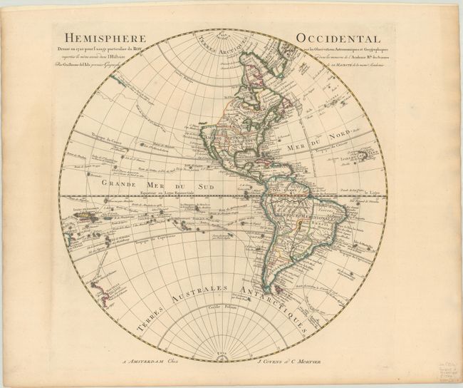
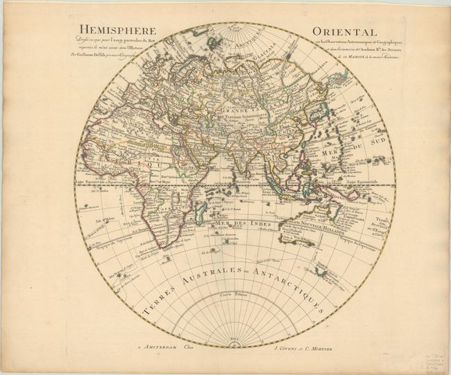
Subject: World

Period: 1730 (circa)

Publication:

Color: Hand Color

Size:
18.5 x 18.8 inches
47 x 47.8 cm
Download High Resolution Image
(or just click on image to launch the Zoom viewer)

This matching pair of hemisphere maps provides a nice view of geographic knowledge in the early part of the 18th century. In the western hemisphere, the northwest coast of North America is completely blank reflecting Delisle's scientific approach to cartography. The French territory of Louisiane takes up the lion's share of North America at the expense of the British colonies. This political bias is due to Delisle's position as geographer to the King of France. Numerous explorers' routes are shown in the Pacific with good detail of the islands in the South Pacific. The western coastline of New Zealand reflects the discoveries of Tasman. A partial coastline appears in the north Pacific with a note about its discovery by Jean de Gama. This notation is repeated in the eastern hemisphere adjacent to a series of islands and Terre de la Compagnie. In the South Pacific, Australia is only partially delineated and is nearly attached to New Guinea. Engraved by I. Condet.

References: cf. Tooley (America) p. 17 #22.

Condition: A

Sturdy sheets with contemporary outline color and light toning along the edges of the sheets.

Estimate: $475 - $600

Sold for: $1,000

Closed on 4/27/2022

Archived